
Since Post Mills Airport has been in the news quite a bit recently because of the unfortunate death of Brian Boland, I thought it would be of interest if I published photos of how this airport is used in winter. Additionally, I get to show photos of NH and VT from the air that have not been previously seen by anyone but me.
The photos in this blog are not new. They were taken in early 2014 on assignment for the Upper Valley Life magazine. Laura Osborne knew I am adventurous, so she gave me this great assignment.
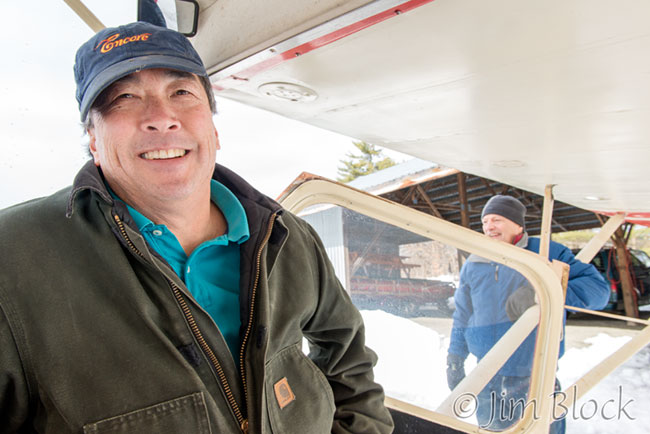
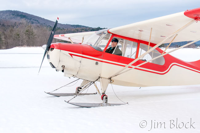
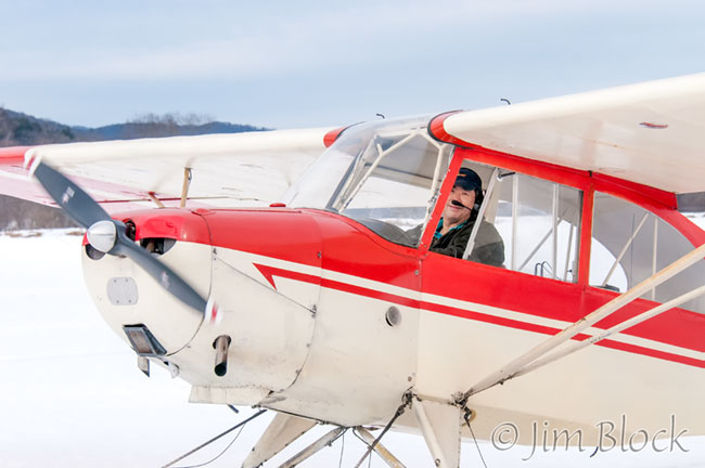
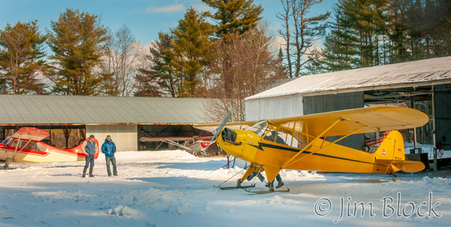
The magazine asked that I focus mainly on Tim Chow who flies a Red-and-White 1946 Aerona Champ (Champion) with skis attached. Rick Sheppe helped greatly and played a significant role in the Upper Valley Life article. I flew twice with him.
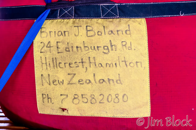
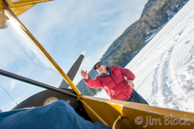
When I arrived at the Post Mills Airport, Tim and Rick pointed to some balloon baskets in the hanger buildings. They said the owner of the airport was a balloonist. Strange, I thought. I took a photo of a large bag in one of the hangers that stored one of Brian’s balloons. Brian had flown all around the world setting endurance and altitude records along the way.
I met first Brian after Tim and I landed at the culmination of our first flight together in January, 2014. In May I renewed our acquaintance when I enjoyed his wonderful Experimental Balloon Festival at the airport and toured his amazing museum. You can see the first festival I attended and some of the exhibits in the Experimental Balloon and Airship Museum if you CLICK HERE.
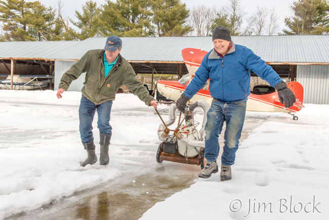
The photo below shows Tim and Rick dragging a heater which is used to preheat the plane engine to help it get started in the cold weather.
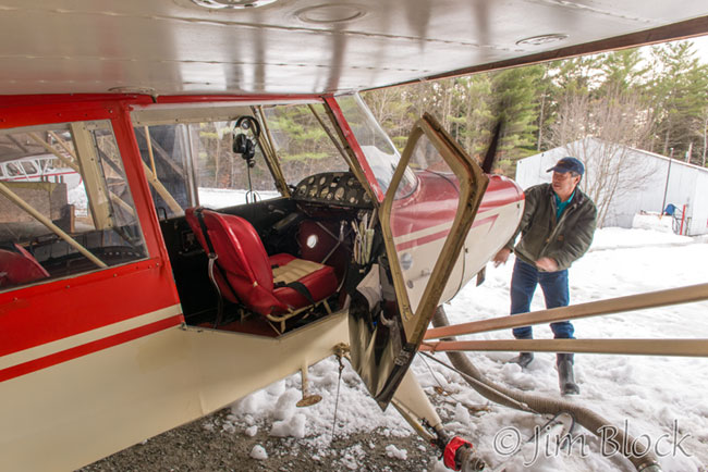
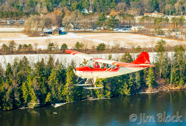
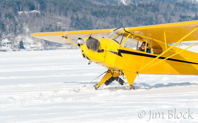
The Aerona Champ is a two seater, but not side-by-side. I sat in back behind Tim. There were controls in front of me and at my feet that I tried to ignore. Apparently one can also fly from the back seat. Here Tim is turning the propeller to help warm up the engine with the heating hoses attached.
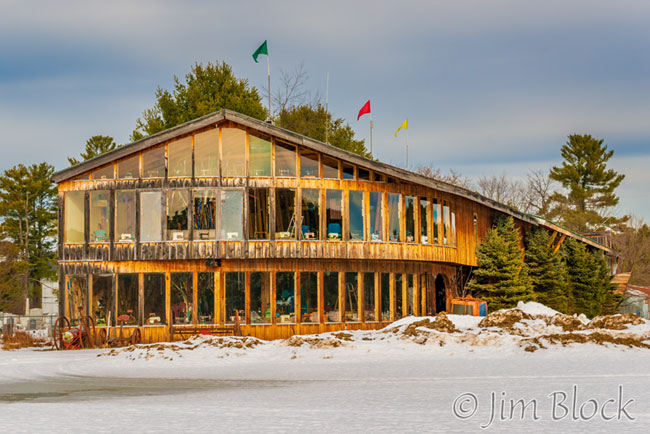
We cruised to the end of the runway and, as we took off, I looked at a building and couldn’t figure out why all of the second floor windows had sewing machines in them. I thought maybe the building housed a sewing factory of some sort. Five months later I learned the correct story — this is Brian’s Experimental Balloon and Airship Museum, also known as Brian’s Museum of Rusty Dusty Stuff.
Soon we were airborne. You can perhaps see the museum and Brian’s house on the left edge of the photo below.
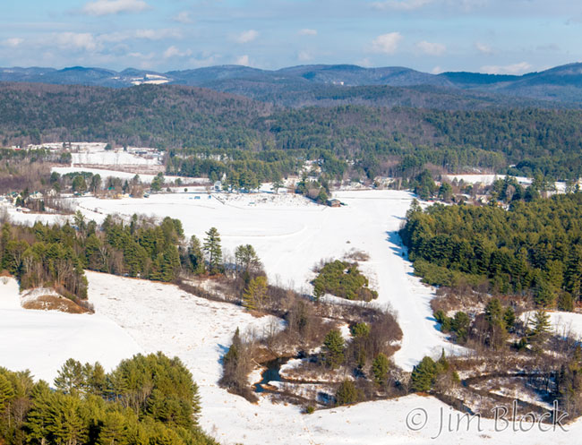
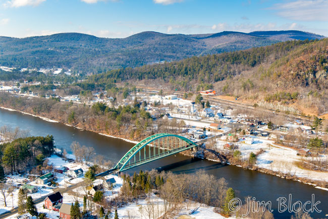
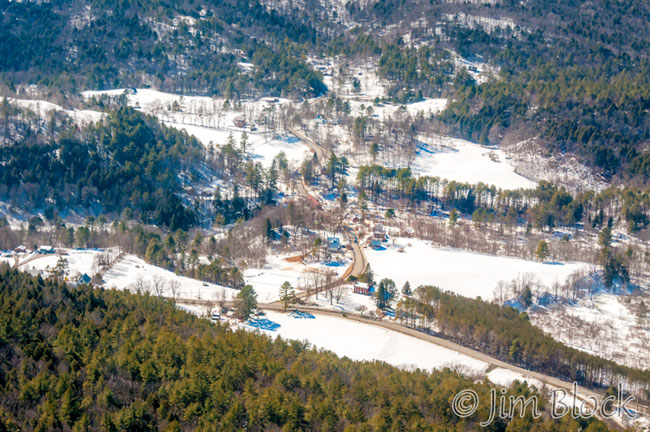
Below is the airport with the museum on the left and the Vermontasaurus in the center.
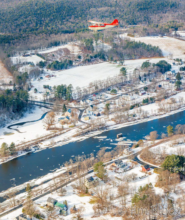
We flew over Lake Fairlee.
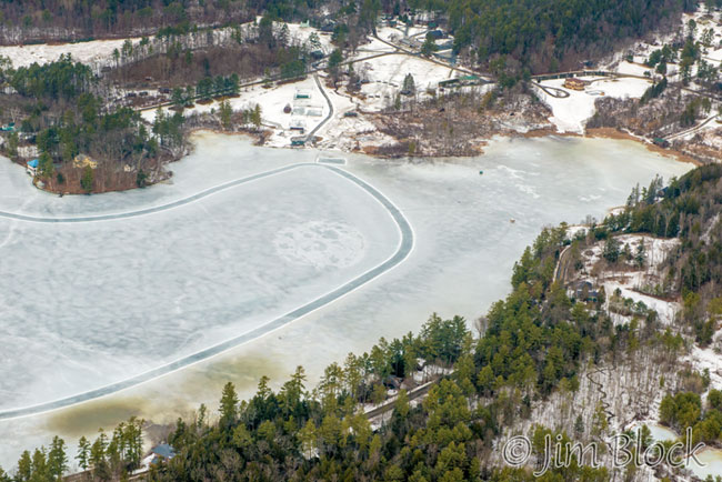
We headed northeast and flew over Lake Morey with its fantastic 4.5 mile ice-skating loop, purportedly the longest in the United States.
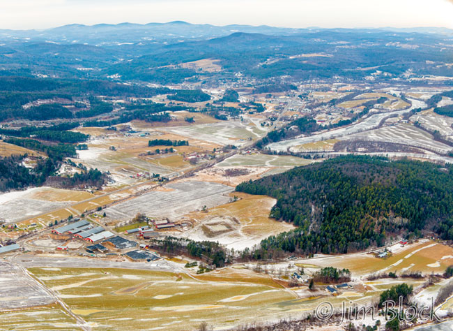
We passed the Newmont Farm in Bradford, Vermont. It can be seen at the bottom left of this photo. The major peaks at the top left of this photo are (left to right) Knox, Butterfield, Burns, and Signal Mountains.
We crossed the river flying over Piermont, New Hampshire.
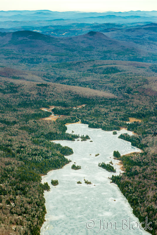
Below us we saw lakes Tarleton (L) and Armington (R).
We flew over Long Pond. This is a wonderful place to kayak. I once took an amazing and wonderful 80-plus-year-old friend on a trip on this lake in my two-person canoe. This was her first ever ride in a kayak.
Long Pond is halfway along the North-South Road from Glencliff to Route 116 in Benton.
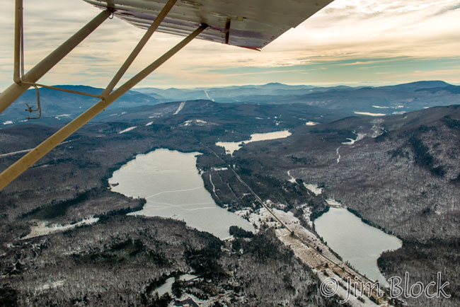
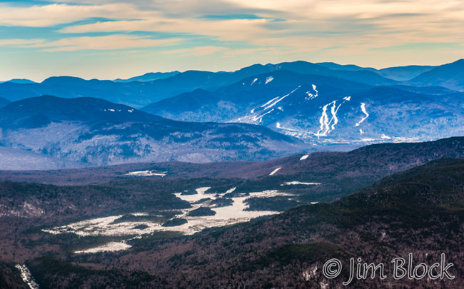
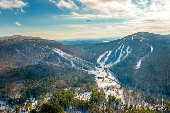
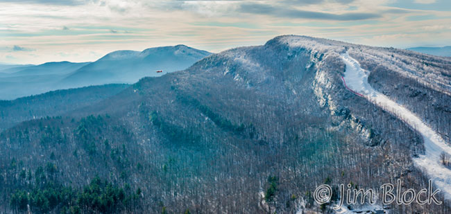
We continued northeast. We could see the ski trails on Loon Mountain in Lincoln in the distance.
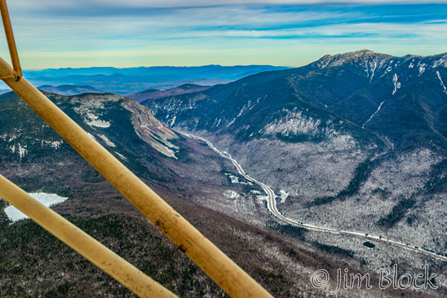
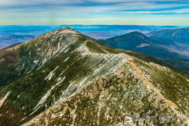
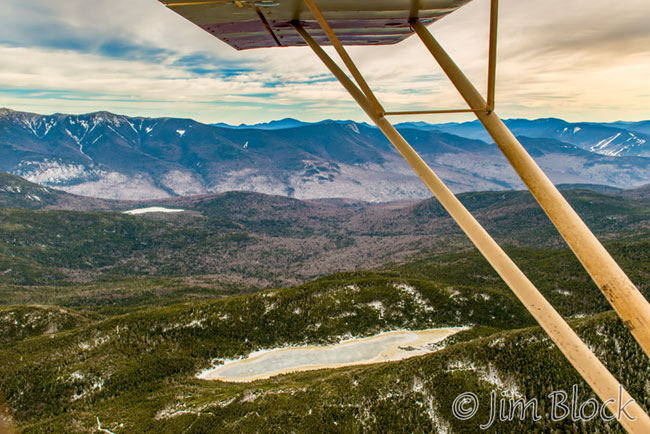
We approached Franconia Notch which can be seen below with Cannon Mountain (L) and Mount Lafayette (R). The lake at the very left of the photo is Lonesome Lake, a place I have visited with my friend Bruce when we hiked Cannon Mountain.
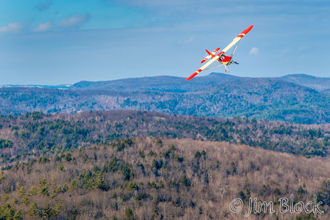
I photographed Tim in the front seat as we headed toward Mount Lafayette.
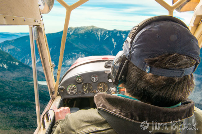
Tim treated me to a truly unforgettable experience. As seen in the photo below, we flew directly toward Mount Lafayette (L) and Lincoln (R) with Mount Washington and the other Presidentials in the background.
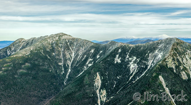
Tim banked left and we cruised the ridgeline between Lincoln and Lafayette perhaps only about 50-100 feet above it. I had hiked this marvelous ridgeline previously, but experiencing it from the air was something very special.
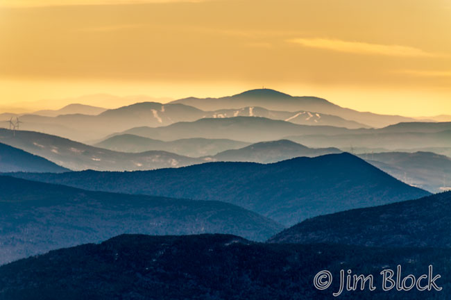
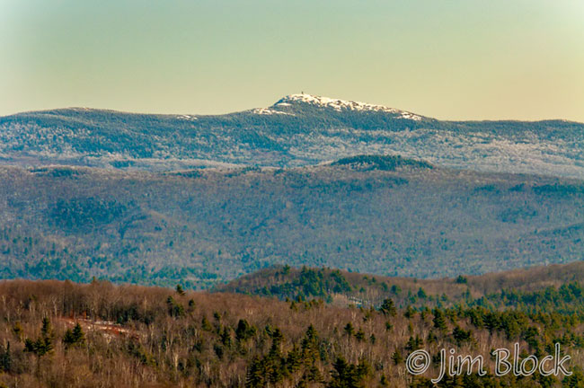
As we turned to head back I was able to get a photo of one of my favorite mountains in the distance. In the photo below you can see the dark summit of Mount Kearsarge with the ski trails on Ragged Mountain in front of it. The sky was turning yellow.
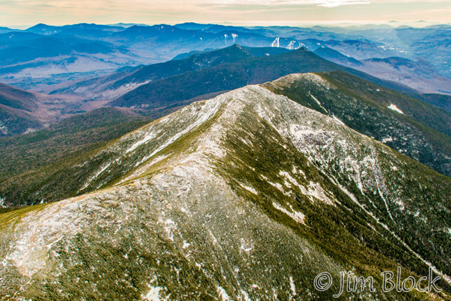
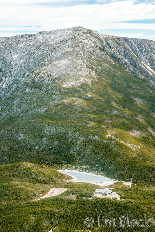
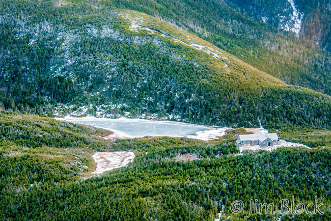
Before we left Franconia Notch we were treated to a wonderful view of Mount Lafayette with Eagle Lake and the AMC Greenleaf hut in the foreground.
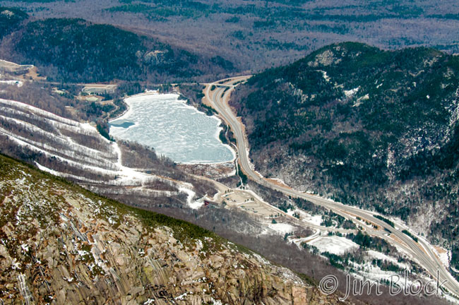
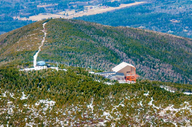
The photo below shows the northern end of Franconia Notch with Echo Lake and the ski slopes on Cannon Mountain. At the top left is Artists Bluff. At the bottom left is the rocky face of Cannon Mountain.
As we flew over Cannon Mountain, I photographed Echo Lake and Artists Bluff in the top photo below and a closer look at the ski lift station near the summit in the second photo.
We passed over Kinsmen Pond which you can see below with Lafayette and Lincoln on the left and Loon Mountain on the right.
The sky to the south was turning an amazing yellow for some reason. I could not resist taking another photo of Mount Kearsarge.
We passed Long Pond again, this time north of it. The photo below shows Long Pond looking southwest with Smarts Mountain in the distance in the center and Mount Cube to its right.
On the way back we were bucking a 50 mile/hour headwind. You would think that would be very bumpy, but the ride was as smooth as it could possibly be. I could barely feel any vibrations in the plane. Our ground speed was actually quite low because of the headwind. I looked down and saw that cars on the roads below us were traveling faster than we were.
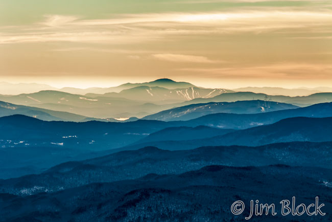
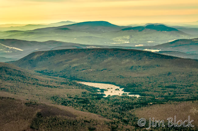
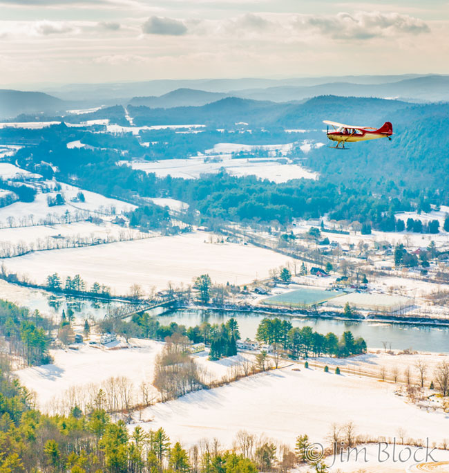
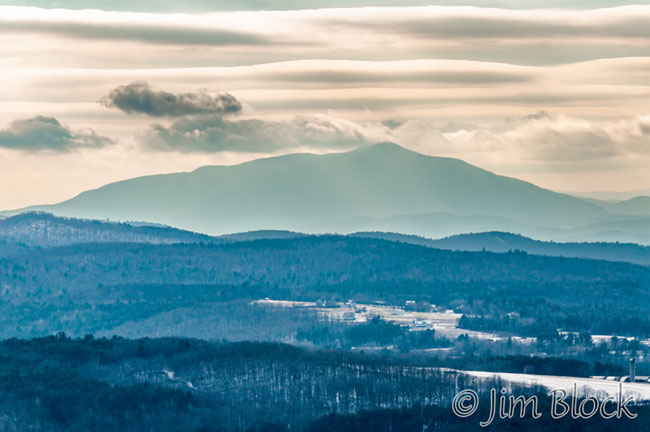
Looking to the southwest, we could see Mount Ascutney in the distance as seen in the next two photos. In the first photo, Mount Ascutney is the dark peak on the horizon and Mount Cube is just left of center.
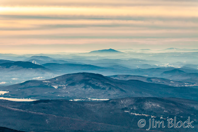
In the photo below Mount Cube is at the bottom left and the ski slopes on Mount Snow are just barely visible to the right of Ascutney.
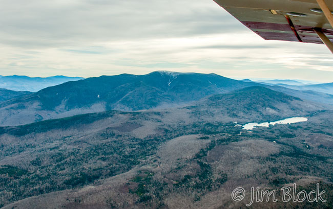
Looking back southeast, here is Mount Moosilauke with Long Pond at the center right.
We passed over North Haverhill and the farmhouse of our good friends Margo and Joe. You can see it in the center of the photo below.
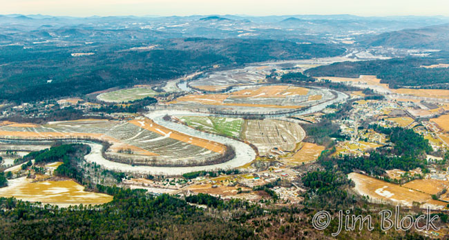
Here is a view of “downtown” North Haverhill with some serious oxbows of the Connecticut River to the west of it.
Bedell Bridge State Park, a wonderful place for birding, is in Haverhill along the Connecticut River. The main area is near the center of the image below.
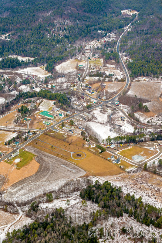
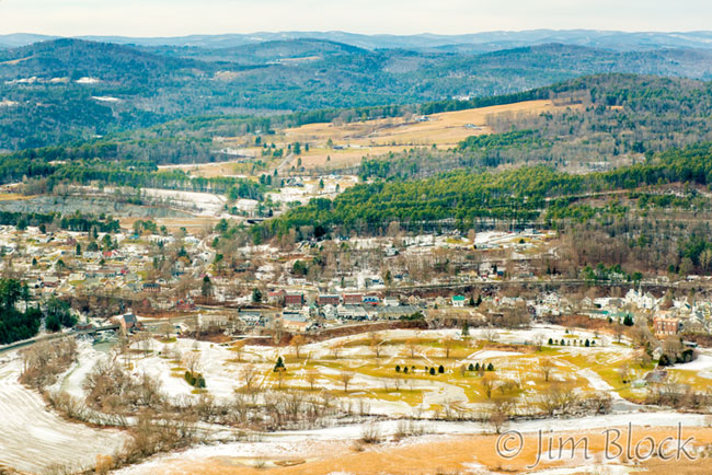
We passed over Bradford, Vermont. Near the center of the photo below is Our Lady of Perpetual Help Church.
Here is an overview of Bradford with the golf course at the bottom of the photo.
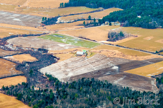
We flew over the Newmont Farm. I had photographed it from the ground many years previously for Vital Communities.
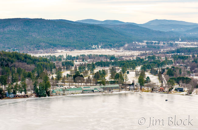
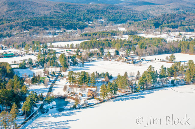
We crossed Lake Morey. The Lake Morey Inn and Resort can be seen in the photo below. The peak at the top right is Mount Cube.
As we approached the Post Mills Airport, I took a photo of the Vermontasaurus, a 122 ft-long, 25 ft-high structure built by Brian with the help from friends.
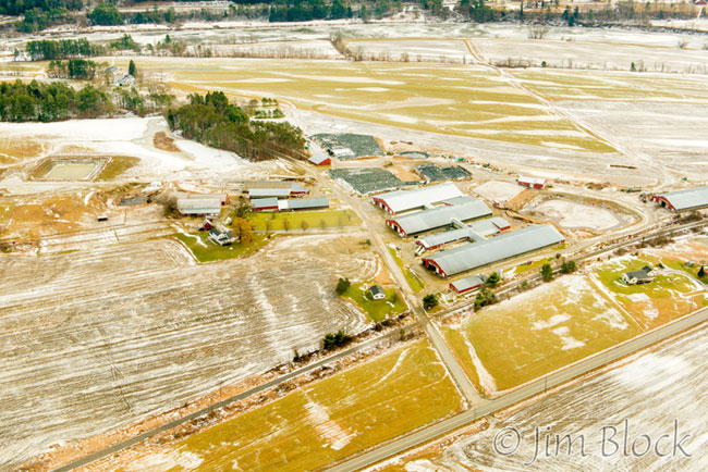
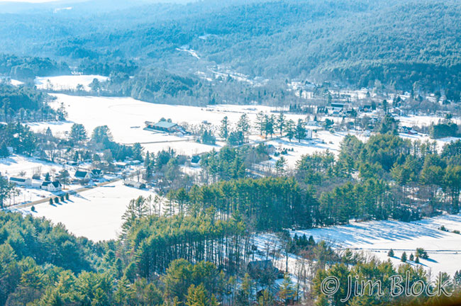
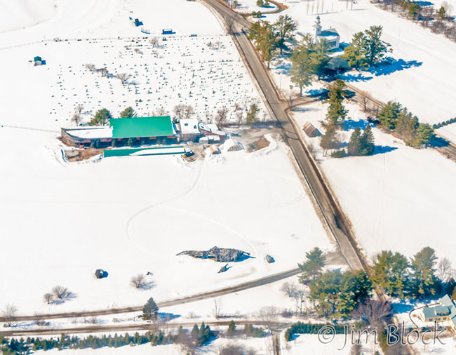
We circled the Post Mills Airport. You can see Brian’s house and museum with the greenish roof just above the center of the photo below. The airport is in the top left quadrant.
The photo below shows the museum and Brian’s house near the center. Along the bottom edge are the hangers. At the top of the photo is Crossroad Farm and to its left is the Taylor Floodplain Preserve.
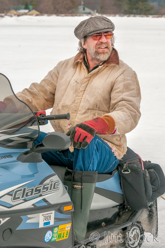
When we landed an interesting character came cruising up to us on a snowmobile.
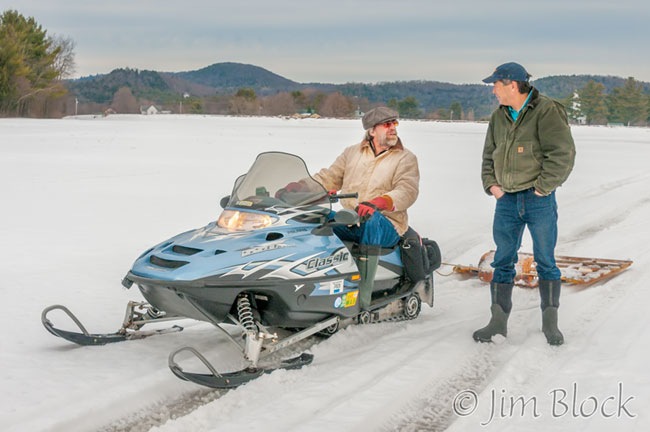
This was my first introduction to Brian Boland. He was certainly a creative, colorful, and generous person. He will certainly be missed.
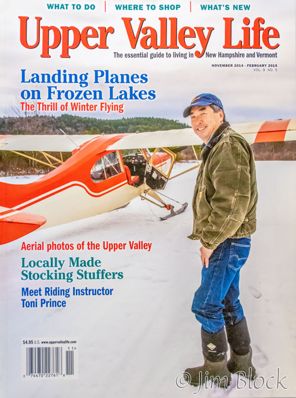
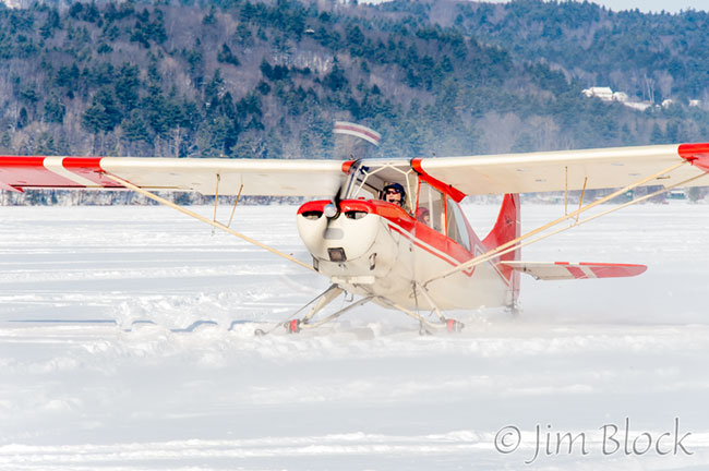
Tim posed near his plane. The magazine used one of the photos I took on the cover.
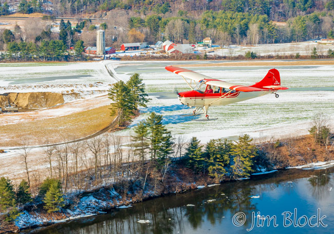
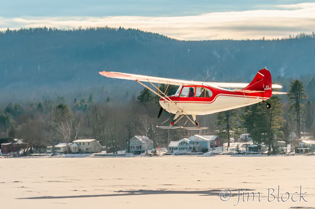
But we were not done yet. Tim did a few takeoffs and landings for me to photograph from the runway.


Tim came back to the hangers smiling, as was I. It was a wonderful flight and an experience I will never forget.
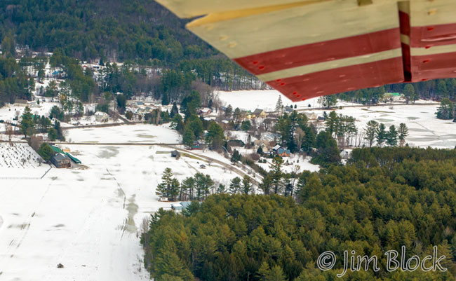
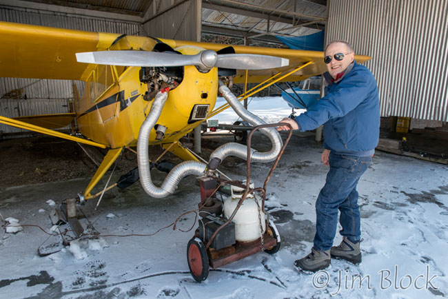
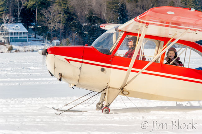
Four days later I was back at the Post Mills Airport, this time to fly with Rick Sheppe so that I could get photos of Tim flying around the Upper Valley. Here is Rick preheating his engine.
In the photo above, you will note the right side of his plane looks normal with the door closed. But that was not the way we flew. We flew with the door completely open, the window hinged up and the lower part hinged down, as can be seen below. That facilitated photography but it also gave us an extremely cold flight.
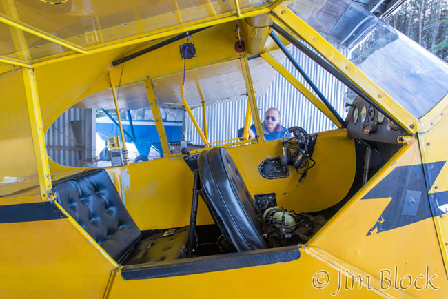
Ricks plane is a 1946 Piper, J-3 Cub. You can see it in the photo below. Tim’s plane is at the left edge of the photo.
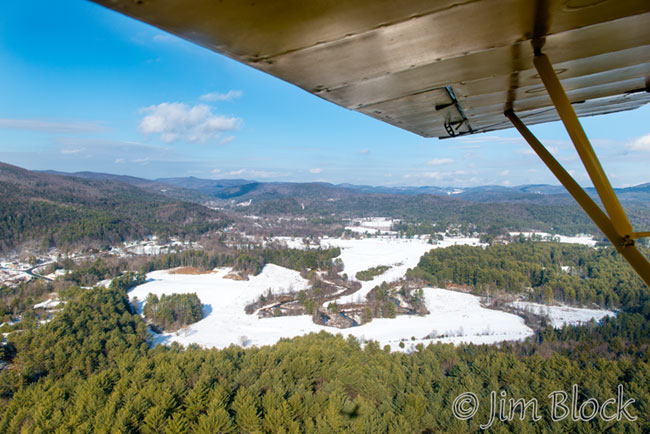
We took off and circled to the south. On the right side of the photo below is the runway heading up toward the museum, which is near the center of the photo.
The photo below shows an even wider view of the airport. The village of Post Mills is in the extreme left of this photo.
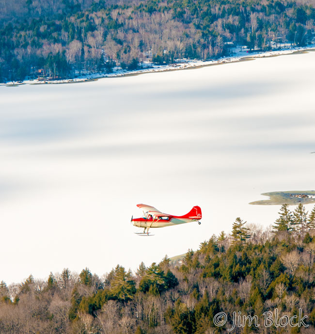
Here is a photo of Tim flying far below us over the bob-houses on Lake Fairlee.
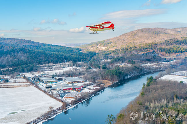
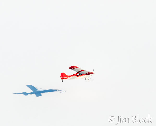
Tim then gained altitude and banked toward us.
We headed east toward the Connecticut River but we weren’t going to cross it just yet. The river is seen in the photo below. Just below the front of Tim’s plane is Holts Ledge. To the right of that are the two peaks of Moose Mountain.
We cruised north toward Fairlee and Orford. The Samuel Morey Memorial Bridge between them can just barely be seen in the left side of the photo below. Near the right edge is Tim’s plane in the distance. Mount Cube is at the top right. Just to the left of it is the bump that is Sunday Mountain.
Below shows Tim’s plane and, just in front and below it, the Samuel Morey Memorial Bridge. At the bottom is the golf course at the Lake Morey Inn and Resort.
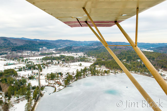
We then crossed Lake Morey. You can see the skating trail and the Lake Morey Inn and Resort at the bottom right of the photo below.
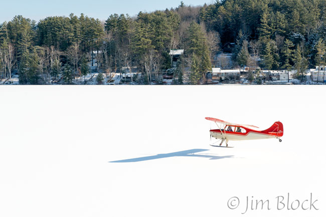
Tim cruised low over the lake but did not land.
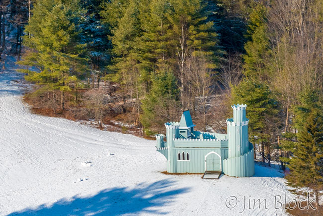
I managed to get a photo of the castle near the north end of the lake.
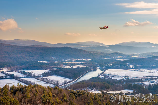
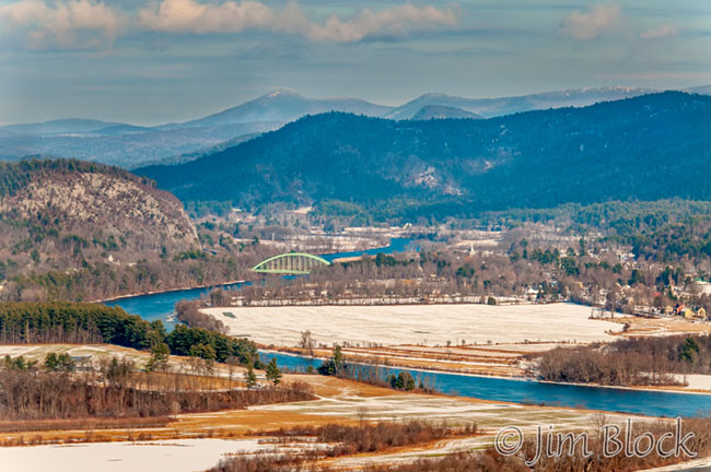
We circled Fairlee and Orford. I took a few photos that included the Samuel Morey Memorial Bridge connecting the two villages. In the photo below the cliffs of Fairlee are on the right side and Tim’s plane is just above the interstate to the left of them. Orford, New Hampshire is on the left side of the river. This photo is obviously looking south.
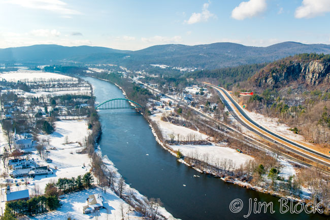
In the photo below, Rick’s plane is over Orford and we are looking southwest at downtown Fairlee. Tim’s plane is above the Fairlee end of the bridge.
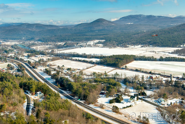
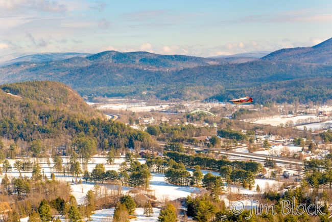
Tim flew over the Connecticut River. We followed along heading south on the New Hampshire side.
The photo below shows the farm at the end of Birch Meadow Road off Route 5.
Tim flew past the Britton Lumber Company in Fairlee.
We passed North Thetford.
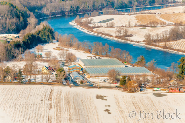
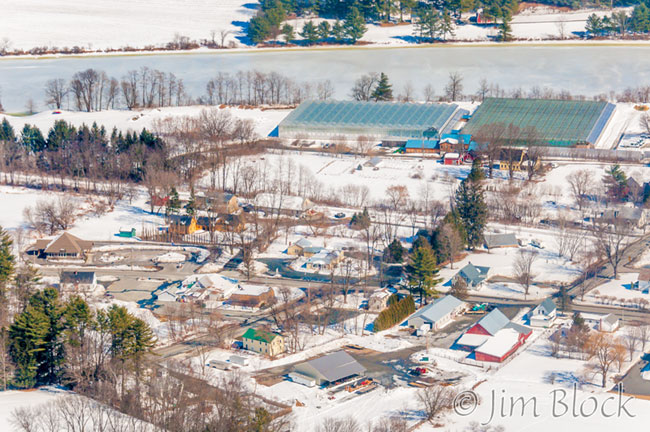
We flew over Lyme. You can see the greenhouses of Long Wind Farm below Tim’s plane just across the river.
Below is Lyme, NH with the Lyme Congregational Church near the bottom center. Along the top is the ridgeline of Moose Mountain. You might just barely be able to see Tim’s plane near the right edge above the village.
Tim’s plane looks like a tiny dot in the sky above the Dartmouth Skiway.
It is still a tiny dot to the left of Holts Ledge and in front of Moose Mountain in the background.
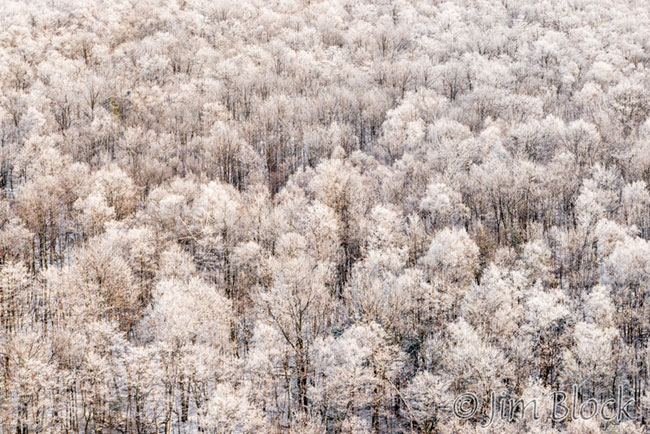
I photographed the frosty trees near the Skiway.
We headed to Goose Pond. Perhaps you can see Tim’s plane far below us just above the middle of the photo below.
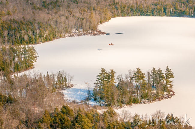
Here is Tim gliding low over Goose Pond.
We got a nice view of Mount Cardigan with its bald summit and Firescrew Mountain just barely to its left.
We circled and I took another photo of Tim cruising by Goose Pond.
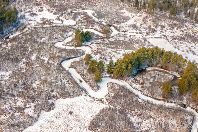
We headed south. Here is the meandering Mascoma River draining Goose Pond.
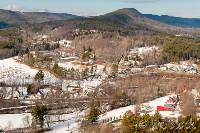
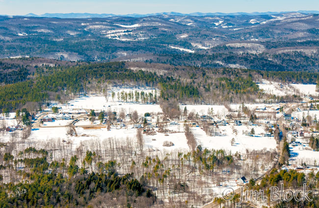
We flew over downtown Enfield. In the photo below you can see the south end of the Moose Mountain ridge at the top.
Tim cruised over Lake Mascoma. We were at nearly the same altitude as Tim.
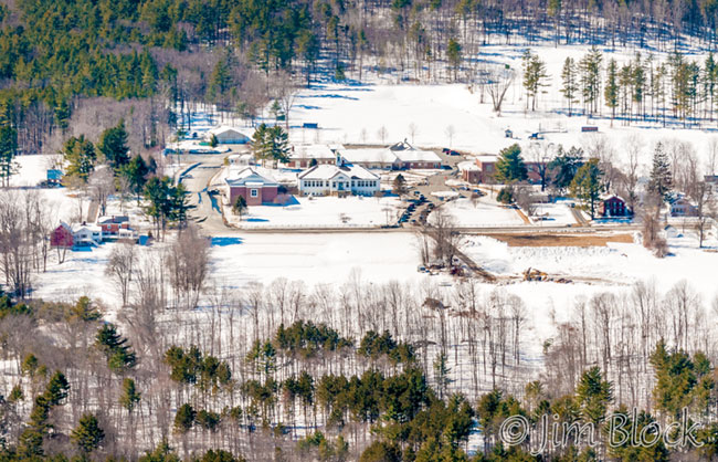
We passed the Enfield Shaker community.
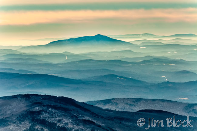
We got a nice view of Mount Ascutney to our south.
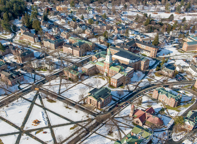
We passed over my house in Etna and headed for Hanover and Dartmouth College.
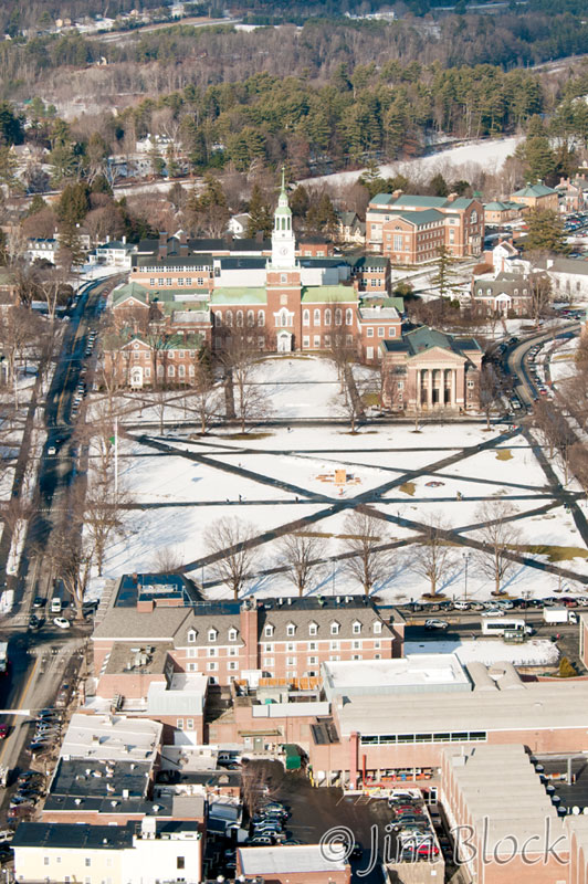
This was a very cold flight since half of the plane next to me was missing. So I wore huge leather mittens. Photography was difficult with the mittens, but I managed.
As we approached downtown Hanover, I noticed my viewfinder suddenly get quite dark. Something was wrong!
It took me only a few seconds to realize that with my gloves I inadvertently pushed the lens release button and while zooming I had partially unscrewed the bayonet lens.
As we passed over the Dartmouth Green I was about to drop a $1600 lens in the middle of it. Fortunately I didn’t. I pulled my camera back into the plane and locked the lens back in place.
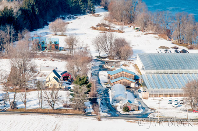
We passed Long Wind Farm in East Thetford. You can get their great organic tomatoes at the Co-op. Claudia does Tai Chi and has also taken a photo course with me.
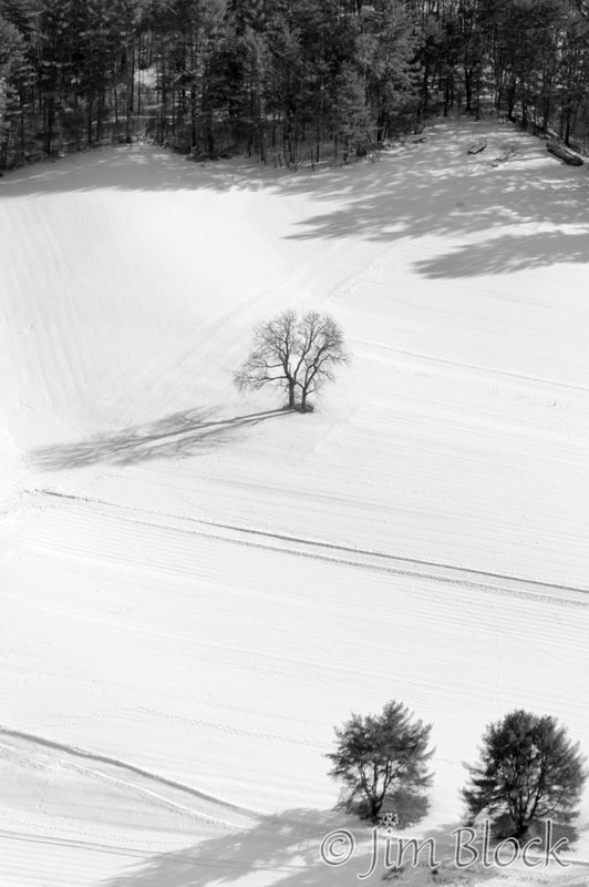
I couldn’t resist a photo of a field with a tree standing alone.
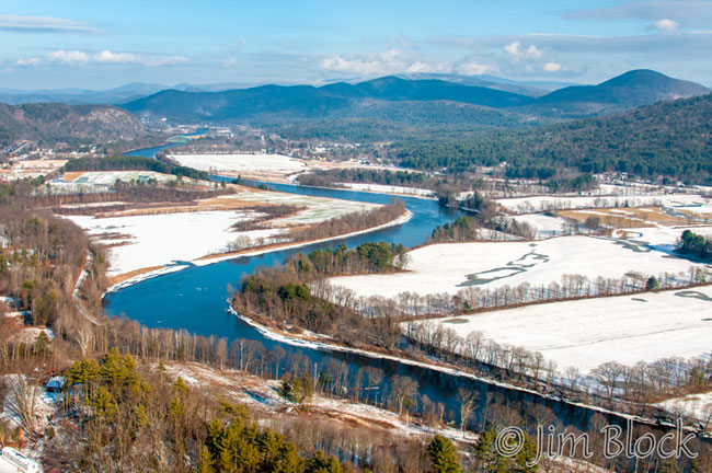
We got a nice view of Orford and the Samuel Morey Bridge looking north. In the background are Black Mountain, a great hike, and Sugarloaf Mountain.
Below is a wider view of the scene which shows the winding Connecticut River south of Fairlee and Orford.
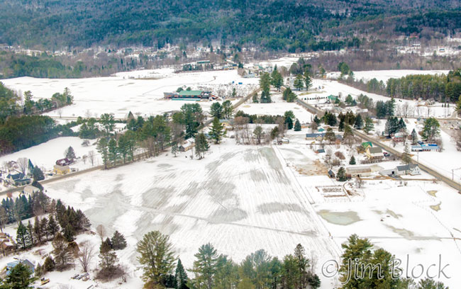
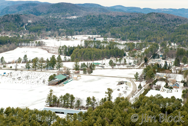
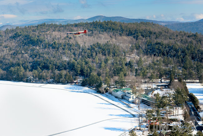
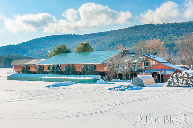
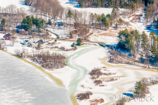
We flew over Lake Fairlee and had a nice view of the area between the airport and the west end of the lake. Brian’s museum is in the center on the very left edge of the photo below. At the top right of the photo is the Crossroad Farm and Taylor Floodplain Preserve. Both are wonderful places to visit. I have birded there with Tim several times.
The photo below shows Brian’s house and museum near the center with the airport stretching to the left.
As we came in for a landing we passed Brian’s house and the Experimental Balloon and Airship Museum.
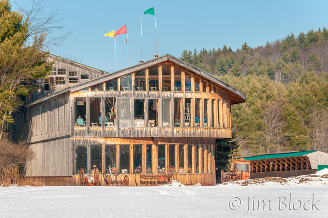
Here is the far end of the museum which looks down the airport runway.
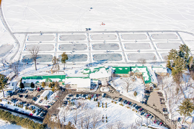
In early February, I was photographing the Vermont Pond Hockey Tournament on Lake Morey which I did for the Lake Morey Inn and Resort for eight years. It was an amazing event with 15 rinks and teams from all over the northeast.
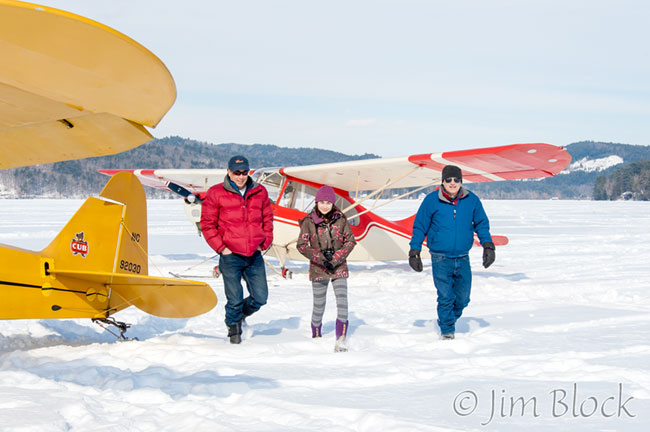
I noticed Tim and Rick flying in and landing on Lake Morey not too far from the hockey rinks. So I walked over to greet them.
Here is Rick in his plane.
And here is Tim with his daughter.
The three of them walked over to chat.
I told them what I was doing and Rick suggested that he give me a quick ride over the resort and hockey rinks so that I could get some photos from the air. I immediately climbed into his plane. Below you see Tim helping get Rick’s plane started.
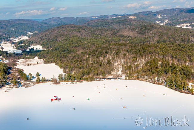
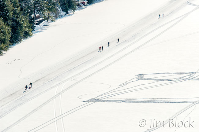
We took off and flew over the skating loop on the lake.
We circled the resort and I took many photos. Here is one showing the 15 rinks and the inn and resort. Just above the rinks in the center you can see Tim’s plane.
That was a wonderful and unexpected flight.
My fourth flight was also unexpected. It was with Tim, so overall I flew twice with Tim and twice with Rick.
Tim lives on the Connecticut River. He hosted a skating party on the ice east of his house in early March. There were three airplanes in attendance at various times. The main river ice was solid but about 10 feet along the shore was open water. We walked onto the ice over a narrow board.
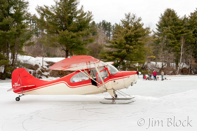
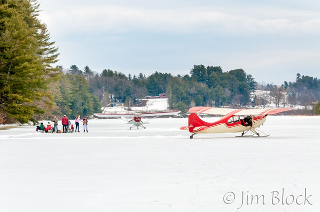
Tim gave several of the attendees short airplane rides, taking off and landing on the ice nearby.
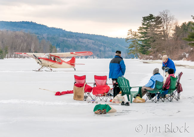
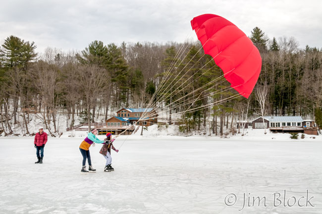
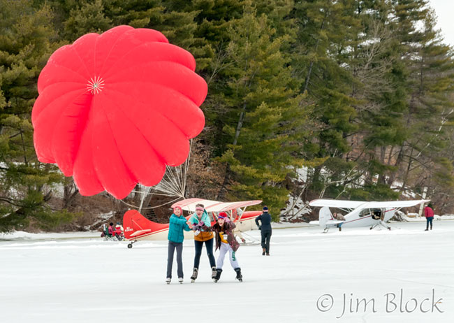
Tim produced a large red parachute which his daughter and two friends used to get a wind-driven ride down the ice.
Tim told me he would leave his plane on the ice overnight, and if I would like to come by tomorrow he would give me another ride. Here it is the next morning.
Tim planned to do a tour of the central lakes of New Hampshire, but once we got up in the air we found that conditions were extremely choppy. So he decided to simply head back to the Post Mills Airport.
We flew over the mouth of Grant Brook. Here is where it empties into the Connecticut River. This is a wonderful spot for ducks in spring. You can see how many can be there is you CLICK HERE. That blog also has photos of a Pine Warbler in an ice storm. One of those photos was used on the cover of a brochure called “Building Resilience”.
We flew over East Thetford. In the photo below you can see the greenhouses of Long Wind Farm just on the VT side of the Connecticut River.
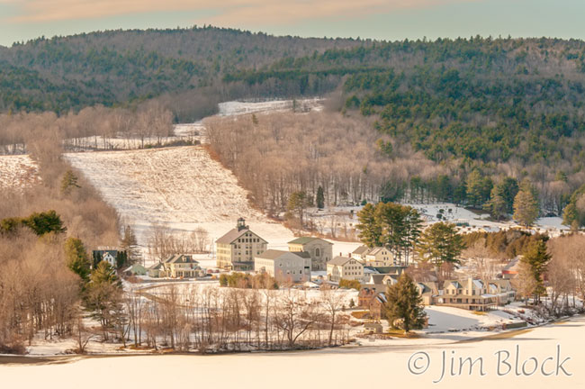
We had great views down toward Thetford Hill and Thetford Academy as can be seen in the photos below.
We flew over Thetford Center. Tucker Hill Road is seen in the photo below curving upward from Route 113. The covered bridge over the Ompompanoosuc River is almost directly in the center of the photo.
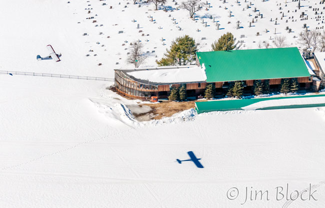
We were joined by another plane that had been on the river the previous day. Here it is flying over Brian’s museum.
I took a final photo of the airport and Brian’s house, museum, and Vermontasaurus before we landed. It was very windy, but Tim sure knows how to handle his plane.
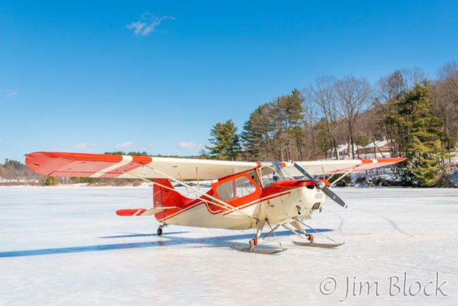
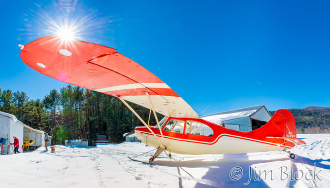
Below is a somewhat distorted view of Tim’s 1946 Aerona Champ. It is distorted because I used a very wide-angle lens and because it is a five-photo panorama. I needed to stand very close to the plane to get the sun star, and I needed five photos to get the entire plane.
Those four flights were certainly wonderful experiences. Thank you, Tim and Rick. And thank you to Laura for giving me this amazing assignment.