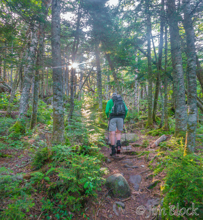
The Caps Ridge Trail up the west side of Mount Jefferson from Jefferson Notch is an adventure. Bruce and I set off shortly after 7 AM on a beautiful warm morning.
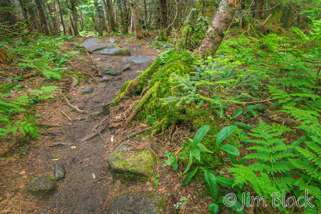
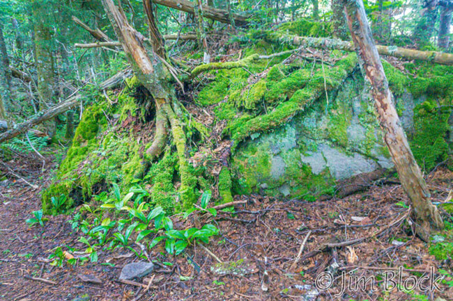
The first mile up to “Potholes” is quite beautiful.
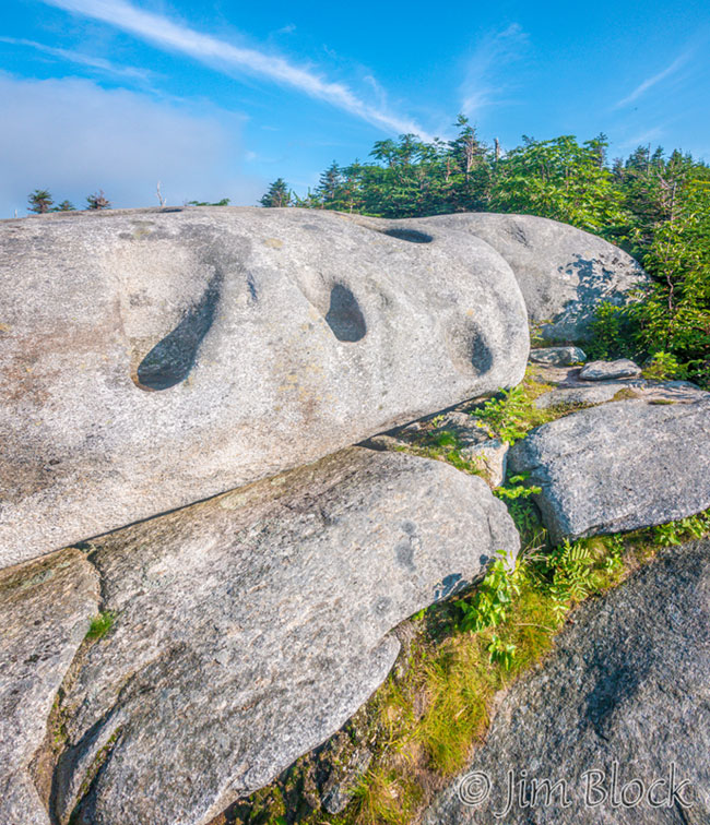
Potholes is the first viewpoint. Soon every spot will be a viewpoint when we are above tree level.
At potholes we got a view of the Presidentials south of Mount Washington. Washington is at the top left in this photo.
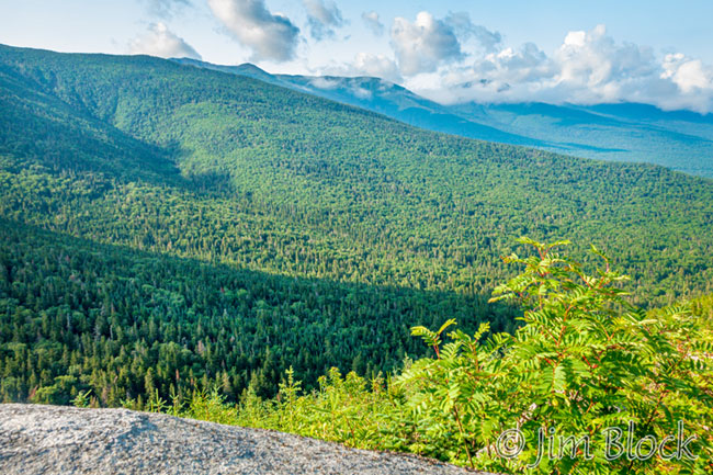
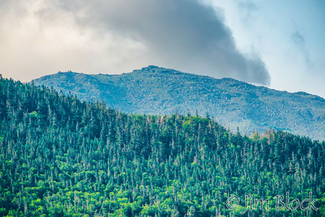
This zoomed-in photo from the same spot gives a closer look at Mount Washington.
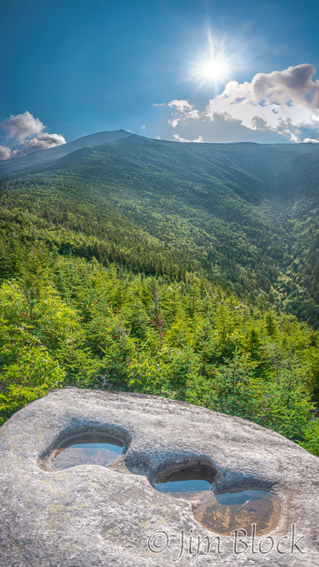 From potholes we had a view of Mount Jefferson. It is the most distant peak in the photo on the left. But for much of the way up the Caps Ridge Trail the summit would not be visible.
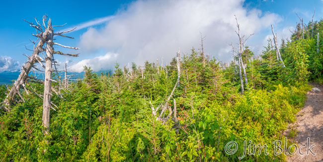
Not long after heading up from the potholes area one finds a viewpoint with totem poles of dead trees. The Image below is a six-photo panorama.
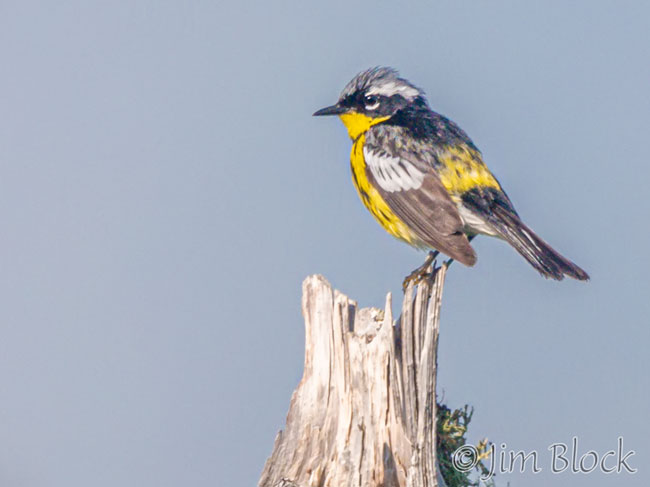
At that spot I was able to photograph a beautiful male Magnolia Warbler…
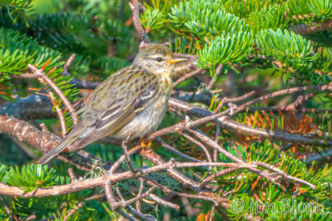
… and a less colorful female Blackpoll Warbler.
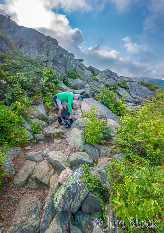
Soon trekking poles become a hindrance rather than a help. They need to be stowed because both feet and hands were required for scrambling up what purports to be a “trail”.
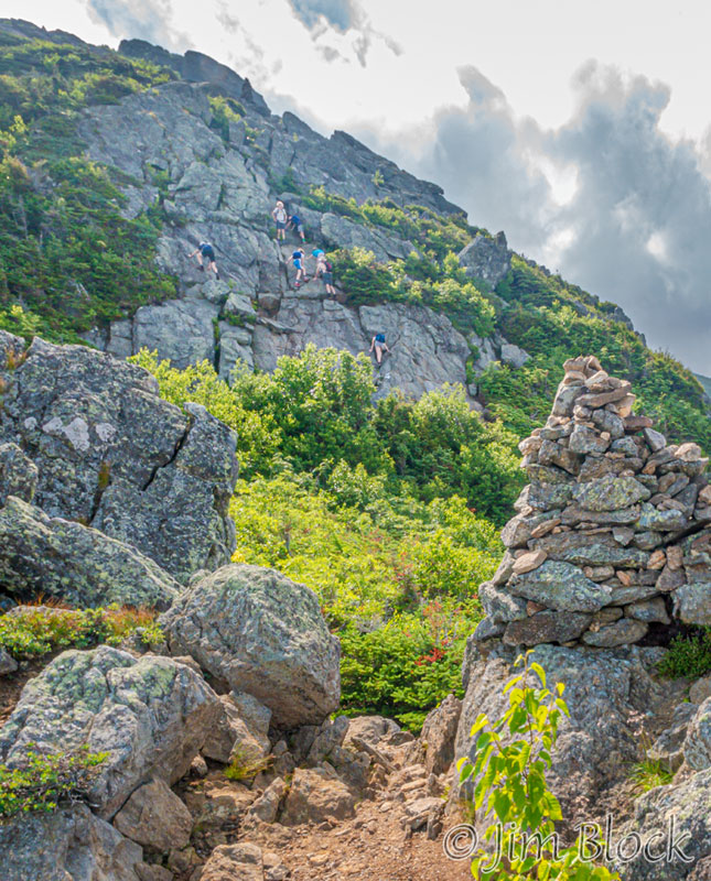
In the photo below one can see a clear trail to the left of the cairn. Beyond it is a cliff that the trail ascends. You might be able to spot young folks scrambling up the cliff face.
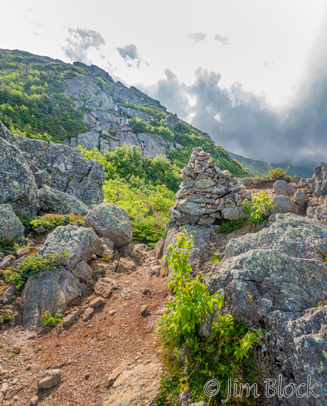
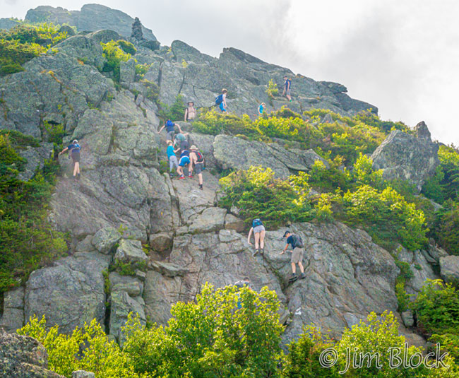
Here is a cropped version of the above photo to better show the rock climbers that we would soon follow.
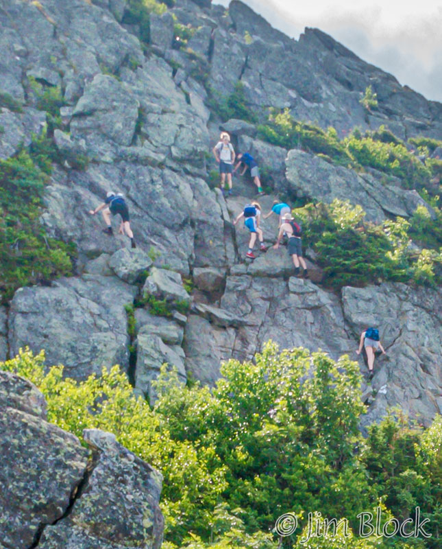
Below is a more extreme crop — hence it becomes unsharp — showing the group working their way up the cliff.
One carefully studies the rocks and ledges to determine the best line upward. It is a matter of finding secure places to put feet and hands while slowly gaining elevation.
Soon one is pondering what it’s going to be like coming back downhill, climbing backwards in many parts.
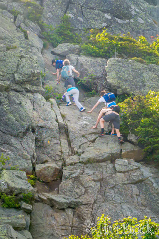
I stopped to put my camera in my backpack. Too often my chest was near the rocks and I feared the camera would get damaged. I used my iPhone instead, as in the photo below of part of the trail.
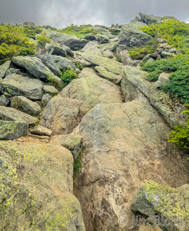
As you can see from the top edge of the photo above, clouds were moving in and shrouding the summits of the Presidentials.
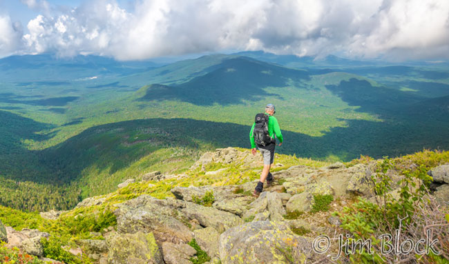
I was still using my iPhone on the way down. It was especially necessary to have my real camera stowed while climbing down since much of the downward scrambling was done backwards, like one climbs down a ladder, but with continuous struggles to find a reasonable foothold. The remaining photos below were taken with my iPhone.
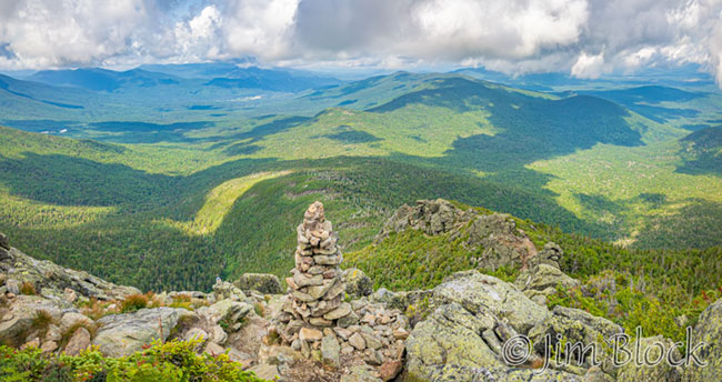
The image below is a three-photo panorama. A tiny distance above and just a bit to the left of the top of the cairn is a dot that is the pothole area. The trail descends to the right of the cairn and then down the rocky cliff below.
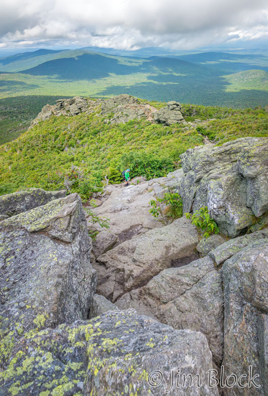
Below is another view of the trail down. You can better see the rocks that were seen in the photos above.
It was a challenging and strenuous hike on a beautiful day in the Whites. We were both very careful and there were no slips.