Generally staying close to home, the only trip beyond Etna during the second half of November was an attempt to photograph Pine Grosbeaks that had been spotted in New London. That trip turned out to be both a success and failure. Failure because the Pine Grosbeaks were nowhere to be seen. Success in that I found a few new spots to photograph. I had a good time photographing some favorite locations.
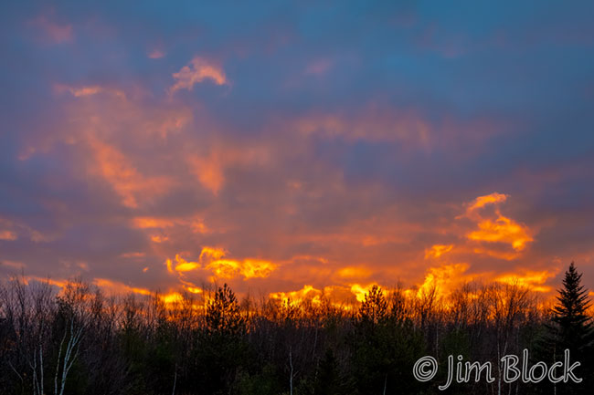
I start this blog with a sunrise and end, appropriately, with a sunset. A few minutes after the photo above was taken, the sunrise had faded somewhat. The clouds were moving quickly that morning.
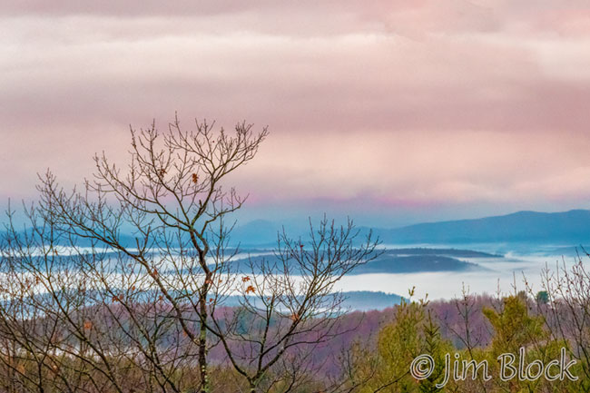
A few seconds after the photo at the top of this blog was taken, I looked west across Vermont and captured the photo below.
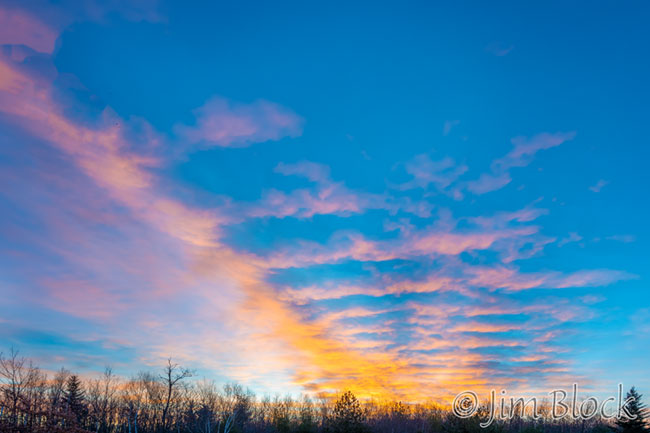
Early in this fortnight, we saw this sunrise from our home. The colorful clouds almost provide a stairway to the heavens.
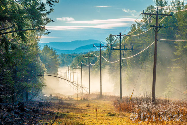
I traveled to New London early in the morning after a night of rain. While searching for the grosbeaks, I spotted a scene I had really never noticed before, even though it is right at the only traffic circle in New London. The view looks southeast along the Hospital Community Trail with Mount Sunapee in the background. I’m not a great fan of telephone poles in photos, but they, along with the fog, provide a strong visual clue to impart a three-dimensional feel to the two dimensional image.
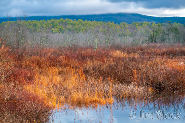
The early morning was alternately sunny and cloudy. From New London Mount Kearsarge was clearly visible, but a short while later from the Lane River in Sutton its peak was shrouded with low clouds. The early sun illuminated the vegetation by the river in a dramatic fashion.
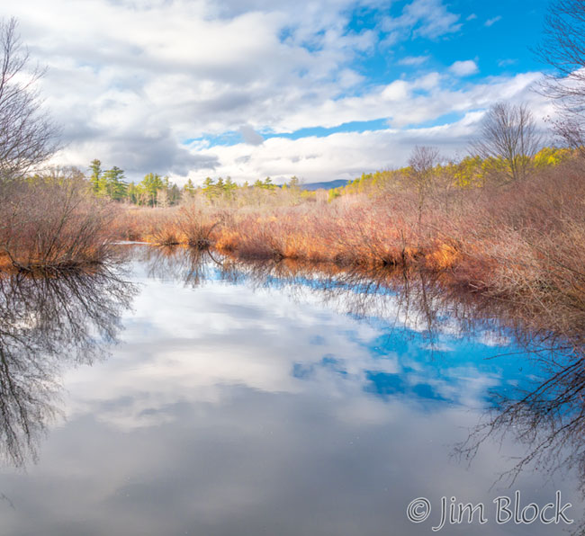
Looking in the opposite direction along the Lane River provided a very different view.
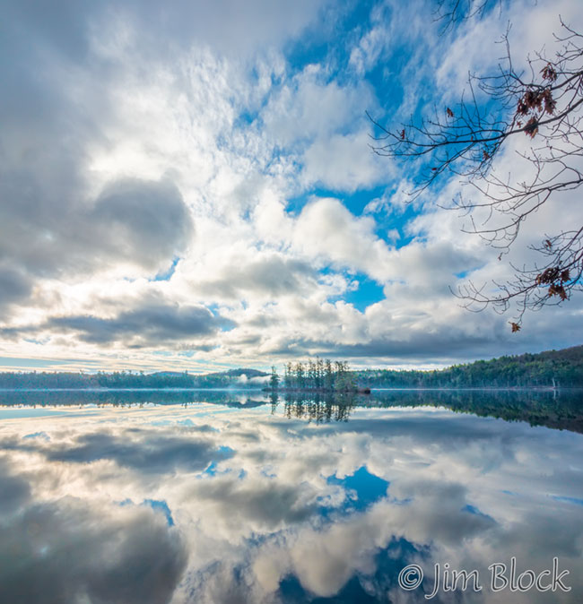
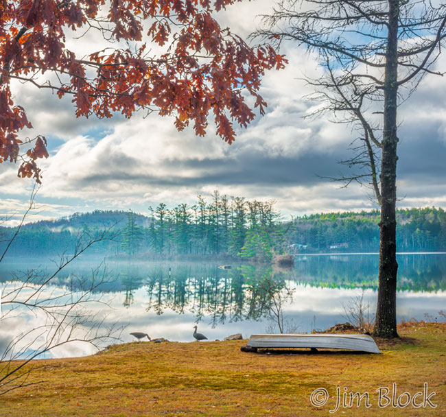
The clouds were dramatic over Loon Island as I drove along the northeast shore of Kezar Lake in Sutton.
As I began meandering back home, I stumbled across a spot I had driven by many times but never noticed. The leaves were gone and the brook was running strongly, so the photographic potential was clearer now. I stopped and explored. There was an impressive tower of stones. I had no idea if this brook had a name, but I christened it “Hominy Stream”.
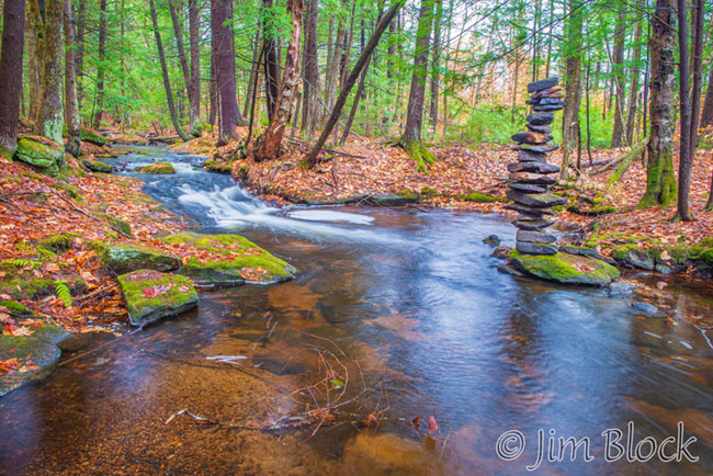
In this area in the later part of the 18th century, homes and an industrial area sprang up along Lyon Brook which drains parts of New London and flows into Keyser Lake. The industries included a sawmill, a grist mill, a cording and cloth dressing mill, a hat factory, and a shingle mill, all powered by falling water. Overtime, this industrial area has been called “Minot’s Square,” Harvey’s Mills,” “Trussell’s Mills,” and lastingly, “Hominy Pot.”
I few days after reaching home, I searched for the proper name of this stream. It is Clark Pond Brook. It drains Clark Pond and joins Lyon Brook before the Chadwick Meadows Wildlife Management Area.
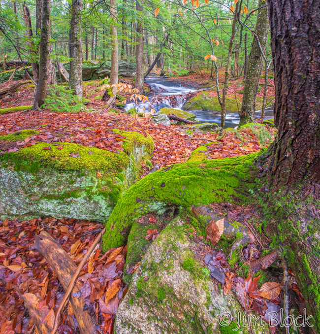
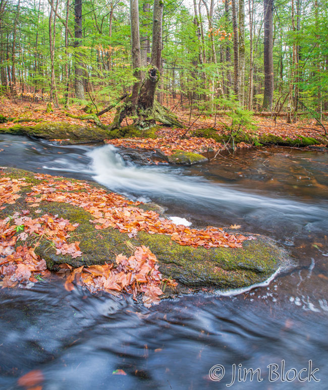
Continuing to drift back toward Etna, I decided to stop at a small but beautiful spot in Grantham along Skinner Brook. The sun had long since disappeared, so the lighting was great for photographing moving water. The recent rain had made the brook quite full.


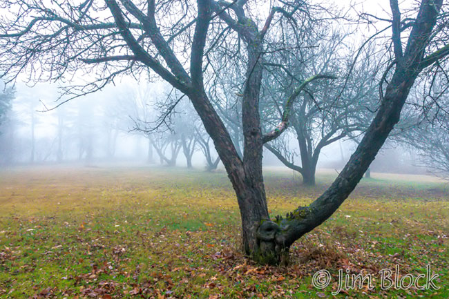
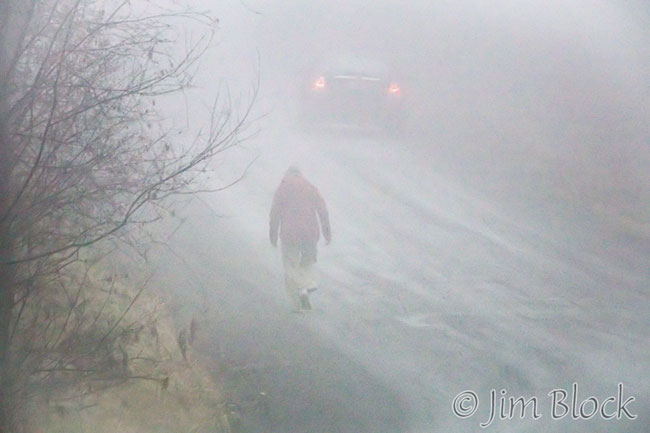
One very foggy day, Jann and I took a late afternoon walk in Etna that allowed me to capture some “moody” photos.
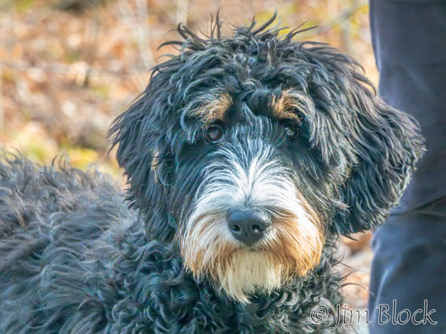
On another walk in Etna, we found a very attractive looking young dog. I asked its proud owner if I could take its photo.
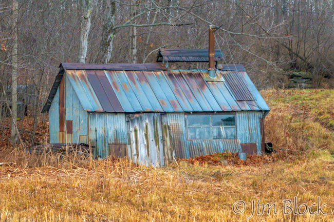
On another hike, I photographed a very old sugarhouse which I believe is still being used in spring. Years earlier, I had an enjoyable time in this shack during sugaring chatting with the real “Doctor Jennings” of Willem Lange’s wonderful story of Etna farmer “Favor Johnson” who lived nearby.
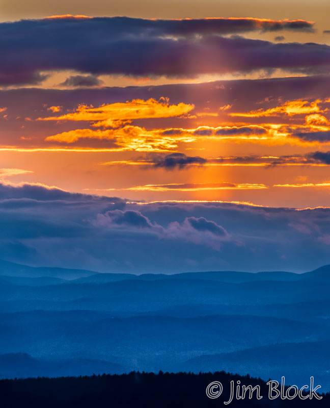
On November 28, there was a sun pillar in the sky at sunset over Vermont. It was not nearly as dramatic as the one we observed during the first half of November but it was still very nice to see.
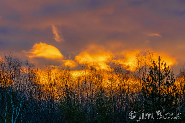
Here are a three more sunset photos from the Last Half of November.


I wonder what December will bring. In any case, I’m sure there will be new things to see and photograph.