Last week I took a completely unplanned hike. I left home early morning planning to photograph birds. But something propelled my car beyond the planned birding spot without stopping. Perhaps it was the email I received from the Upper Valley Land Trust, but I wasn’t thinking about that. In the process I discovered a very nice hike through a beautiful forest, the Smith Pond Shaker Forest owned by the Upper Valley Land Trust.
Skipping the birds at Ice House Road (I would return there two days later), I headed to the Lower Shaker Wildlife Management Area to look for an eagle that I heard had been there at times. But no luck. There is one nesting on an island in Lake Mascoma. It can be seen at a huge distance from Lakeside Park.
Since I was near where I thought there was a trailhead to Smith Pond, I decided to drive a little farther east and check out the Route 4A parking area for Smith Pond. I found it easily and parked there. Then I figured since I was there, maybe I should head up the trail.
But I had made no preparations at all for hiking. In my car I had no backpack, no trekking polls, and no water! But I did have five cameras (not counting my iPhone), four tripods, and extra lenses. The light was great for waterfalls and rain wasn’t predicted for about three hours. So I grabbed two cameras and my medium weight tripod and headed up the trail.
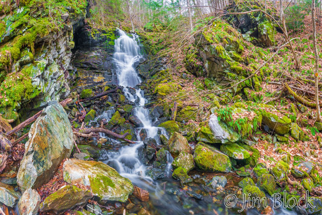
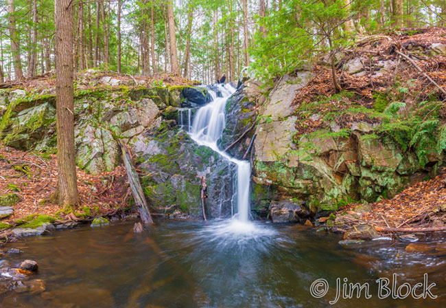
I soon got to a sign that told me that Big Dog Falls was 1.9 miles away and Little Dog Falls was 2.2 miles away. No problem. The sign clearly implied it was only 0.3 miles from Big Dog Falls to Little Dog Falls. But the sign, while accurate, was misleading. It is actually 1.2 miles between the two falls. Big Dog Falls is off a 0.4 mile long side trail.
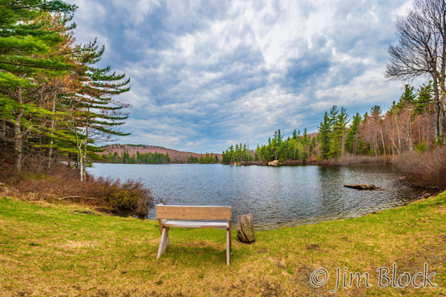
In any case, I made it to both falls as well as Smith Pond. I also took a short detour near the start to see an impressive Shaker Spillway.
The Shakers build five dams in the Smith Pond area and lots of canals to provide water for power and irrigation for their village by the lake. The trail goes along some of these canals.

I walked in light rain for the last 1.4 miles but overall had an excellent time. I logged 5.8 miles with 1,142 feet of up. This hike can be managed on snowshoes. It also can be done as a loop heading two miles to the Smith Pond Road trail head, then up to Smith Pond and back down the trail that I hiked up and down.
You can read more about this area and see many more photos I took on this hike if you CLICK HERE.