This page is the beginning of some panoramas from a trek around the Annapurna Range in Nepal in March and April of 2011. More will be added, so please check back.
You can click this image to get to a site where you can zoom way in then pan around. When you get there, click the double arrow above the image on the right to see it full frame. Please wait for the resolution to download. You can use the + and – keys to zoom and the arrow keys to scroll. Or use the scroll wheel to zoom and the left mouse to drag.
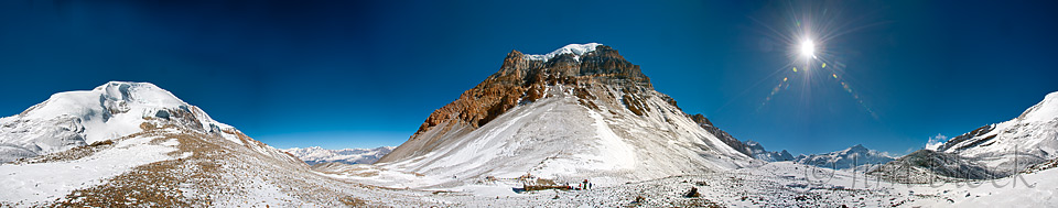
Thorong La or Thorung La is a summit pass located 5,416 metres (17,769 ft) above sea level in the Damodar Himal, north of the Annapurna Himal. I took the image below from a “hillside” above the pass. You can zoom in to the trekkers and the “tea house” below. Muktinath is to the left and Manang is to the right. We started our over-4-hour climb to the pass with headlamps at 4 AM. Location: 28 47′ 37″ N and 83 56′ 14″ E.
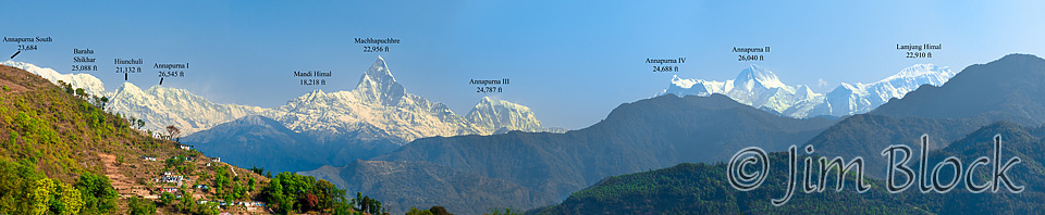
The panorama below was taken during a short visit to the Bindabasini Temple in Pokhara at the end of our trek. I have labeled the mountains. You might have to zoom in a bit to read the labels.
This is a pan from earlier in the trip as we started getting great views of the Annapurna Range from the north. The mountains are labeled on the version you can zoom into.
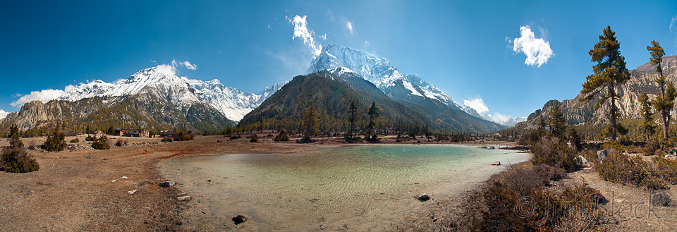
This is the day we walked from Pisang, and its beautiful view of Annapurna II from Upper Pisang, to Manang where Annapurna III and Gangapurna spread out just in front of us, seemingly just a short walk away. You can see the glacier on the right flank of Gangapurna if you zoom in. The next day—a “rest” day—we hiked high up the side of Gangapurna to a great view of the glacier and the lake below it.