Four friends spent two weeks in Iceland in early May. We toured much of the southern coast, the Golden Circle, the Snaefellsnes Peninsula, the West Fjords, and Reykjavik. We rented two cars so we could travel independently — two of us were “focused” on photography and two were mostly into hiking. Marc and I alternated driving the car we shared.
We had all our dinners and some of our breakfasts together, with pairs alternating buying and cooking dinners for two nights and two nights washing dishes. We stayed in Airbnbs except for the first two nights. We ate no meals at restaurants in Iceland. I used a credit card for everything — Iceland is nearly a cashless society. It was a wonderful adventure that I shared with Martha McDaniel, Stephen Plume, and Marc Beerman.
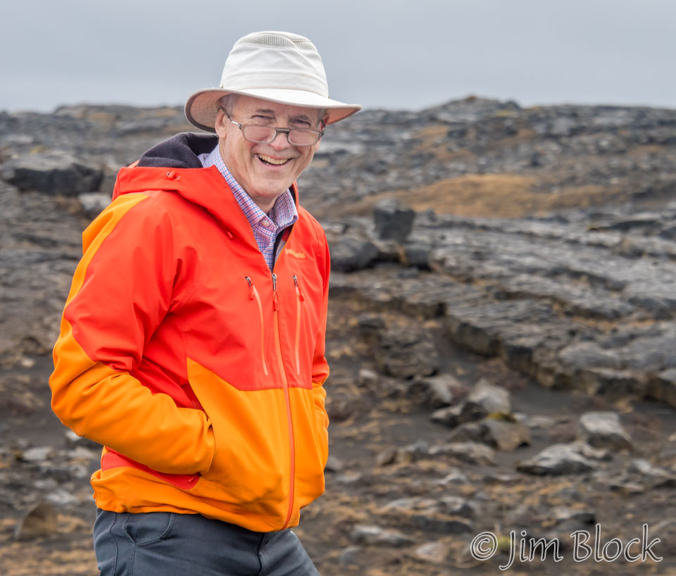
We had left Boston at 9:30 PM and arrived in Iceland at 6:30 AM after a short 5 hour flight. With little sleep, we would have a long day driving to our first lodge at the Hali Country Hotel. But first Stephen had a 4+ mile hike planned for us over lava to the Hafenberg bird cliffs. Here is Stephen about to set out over the lava.
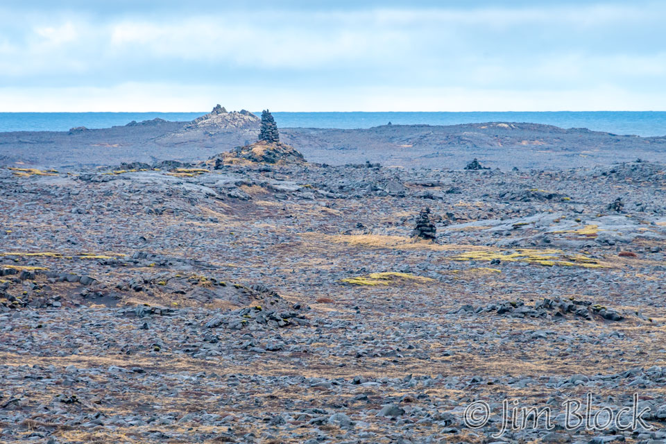
This shows where we hiked to get to the bird cliffs. They were nice, but more spectacular ones awaited on the Snaefellsnes Peninsula and the West Fjords.
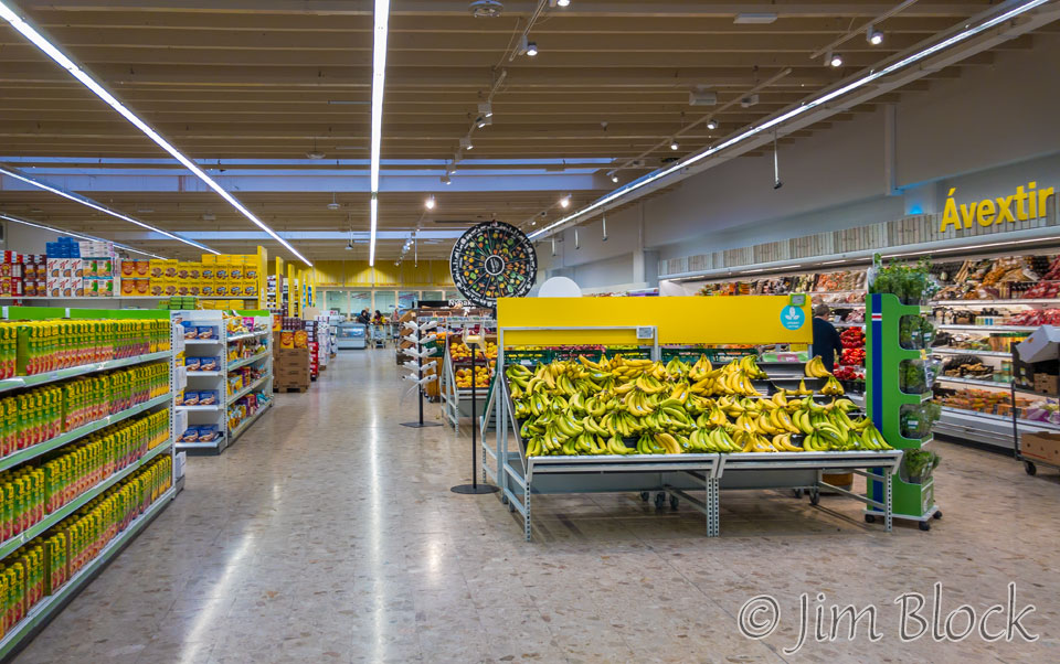
We stopped at Selfoss for groceries at the nicest grocery store we saw during our time in Iceland.
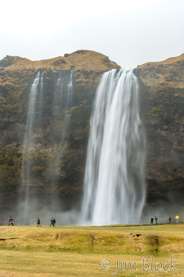
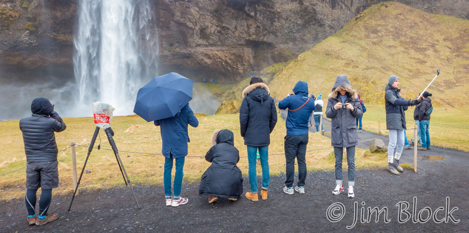
Heading east along the southern coast, we stopped at Seljalandsfoss, a popular tourist waterfall that you can walk behind.
But, I was more interested in the folks taking selfies than the falls. We saw a lot of selfie sticks in Iceland, just as we did in Italy. That is my tripod on the left with a Hanover Coop Grocery bag protecting my second camera from the drizzle. I take these very sturdy bags everywhere — they come in very handy at times.
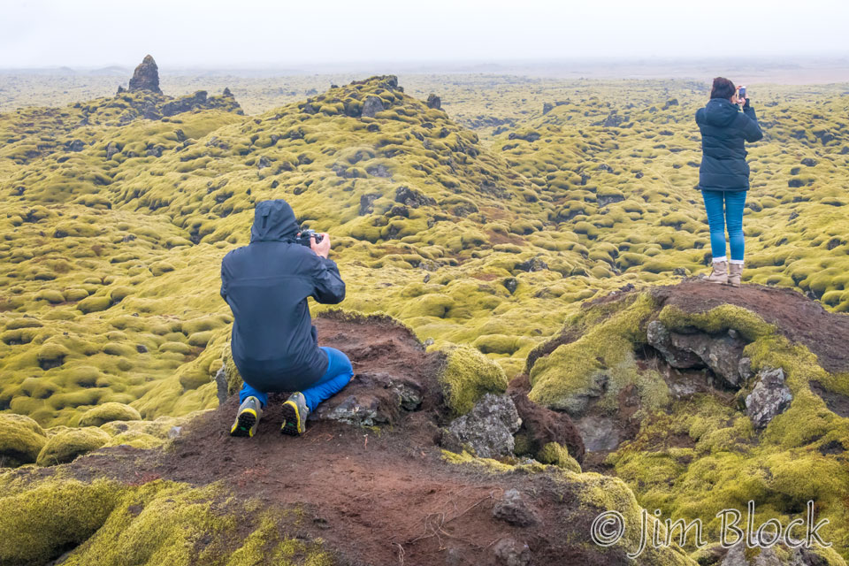
We continued east along the Ring Road, stopping to view an amazing moss-covered lava field. I use the pair of tourists in the photo for scale.
The Ring Road was narrow with no shoulder and a steep-sloped drop-off on both sides that would likely cause the car to roll. We drove carefully. We took turns driving, switching every two hours or so. Our little Citroen had an automatic transmission that shifted like a 15 year old learning to drive with a manual transmission.
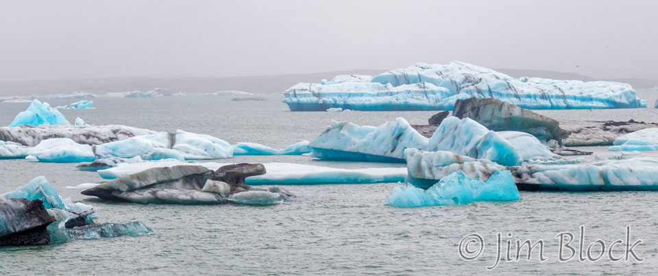
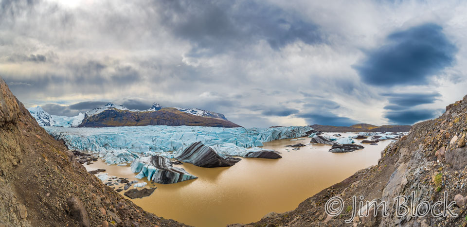
A bit before 6 PM — it was a long drive — we reached the amazing Jokulsarlon Glacier Lagoon. The Glacier Lagoon flows through a short waterway into the Atlantic Ocean, leaving chunks of ice on a black sand beach. It wouldn’t be until the next day that we experienced the other-worldly sight along the beach on the other side of the highway.
Below is a 20-photo panorama of the Glacier Lagoon. You can’t see much in the photo here, but if you click this image you will be taken (in a separate tab) to a site where you can zoom way in then pan around. When you get there, click the double arrow above the image on the right to see it full frame. Please wait for the resolution to download. You can use the + and – keys to zoom and the arrow keys to scroll. Or use the scroll wheel to zoom and the left mouse to drag. For scale, check out the people on the right side of the image.

Marc and I were following Stephen and Martha. We started to worry about our dwindling gas supply, not sure how much to trust the fuel gauge in this unfamiliar car. We passed a gas station and thought about stopping, but it looked closed. Later we realized that the pumps are always available for use with a credit card.
When we checked into our lodge for the night, we asked about the nearest gas station. Well, there was one around 40 km back toward Reykjavík and another about 55 km ahead in Höfn. We weren’t too fond of heading back, so we decided that we would risk the trip to Höfn in the morning. The guidebook stated that Höfn “is pronounced like an unexpected hiccup (just say “hup” while inhaling).” I practiced and entertained Marc the next day.
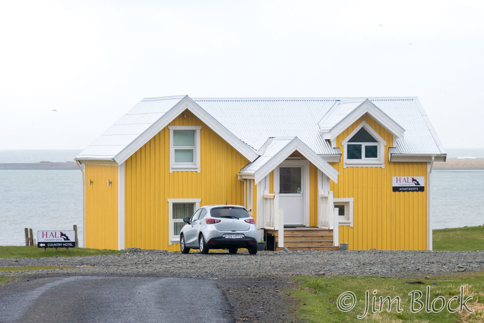
The Hali Country Hotel had a fabulous breakfast buffet. Almost anything you might imagine was available, and we generously sampled many of their offerings. For sleeping and dinners we had a very nice two-bedroom, self-contained apartment seen at the right.
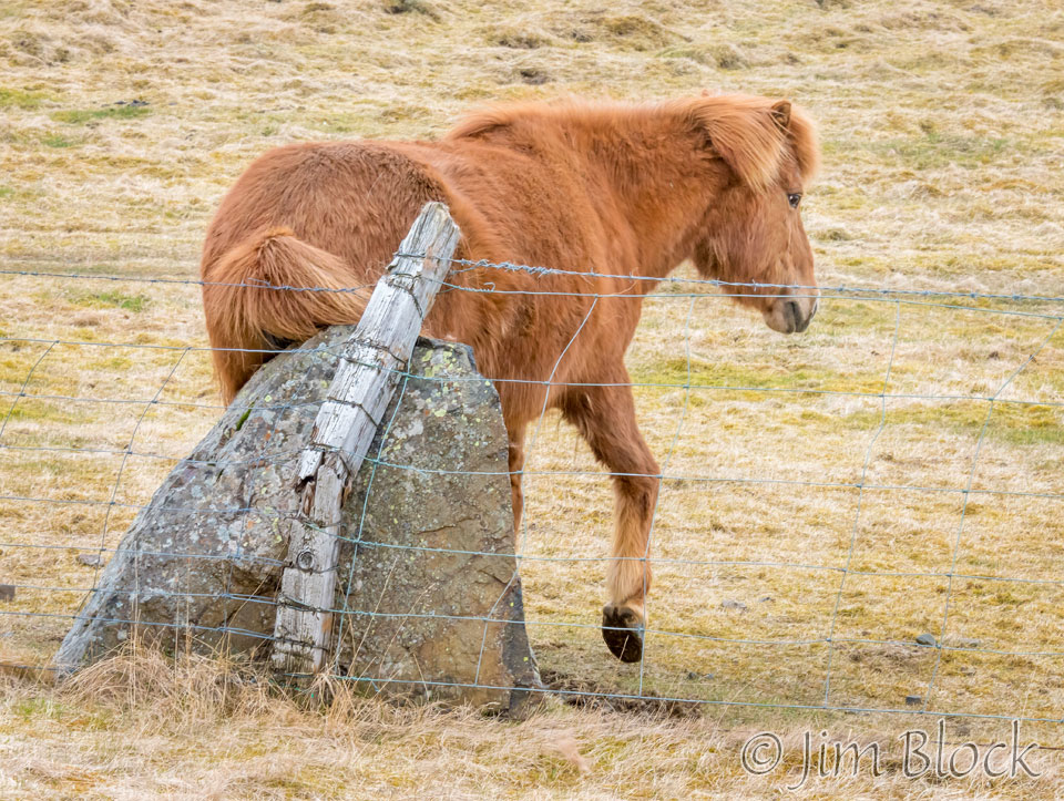
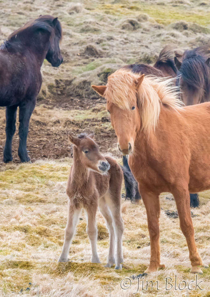
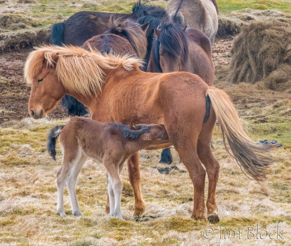
During our drive to Höfn, we got our first photos of beautiful Icelandic horses. They really love their horses in Iceland. And I got a “butt shot” of one. At this point Marc and I each relayed some photography-oriented butt shot stories. I don’t recall his, however I told him about a presentation I saw at a camera club of a trip to Africa. Every photo had the animal’s butt facing the camera indicating the animal was about to depart. We nicknamed the photographer “butt shot Al”.
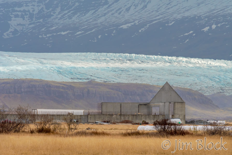
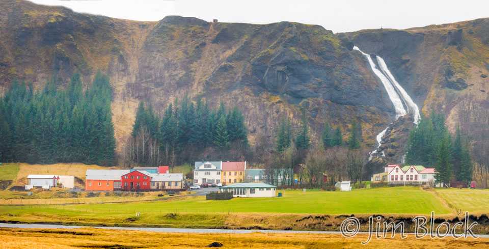
Before reaching Höfn we found this amazing scene with light colored grasses, a huge old barn, hills, a giant glacier, and a snow covered lava mountain. This background is Vatnajökull National Park.
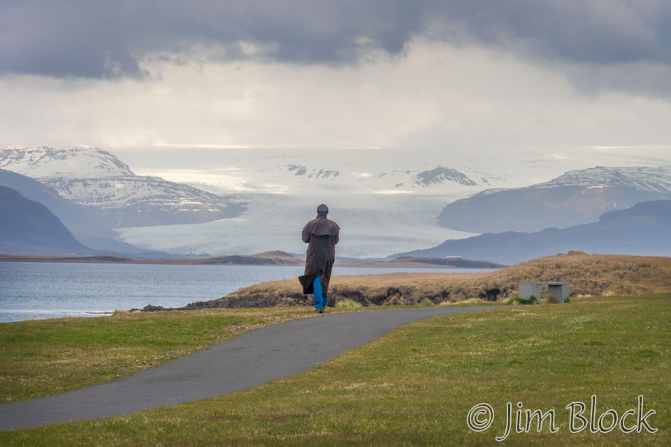
Höfn is a charming place. We hiked along the shore and through part of an amazing and very challenging golf course. I got very turned around with the overcast day and lack of sun. Below is a photo I took of Marc with glaciers in the background. I thought I was looking southeast but this photo actually looks northwest toward Vatnajökull National Park.
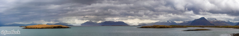
Below is a 9-photo panorama looking west from Höfn at Vatnajökull National Park. We didn’t know it at the time but Stephen and Martha were doing a challenging hike up over rugged trail-less terrain somewhere in the far background of this photo. I wonder if they can spot where they hiked by zooming in after clicking this image.
If you click the image below you will be taken (in a separate tab) to a site where you can zoom way in then pan around. When you get there, click the double arrow above the image on the right to see it full frame. Please wait for the resolution to download. You can use the + and – keys to zoom and the arrow keys to scroll. Or use the scroll wheel to zoom and the left mouse to drag. For scale, check out the people on the right side of the image.
Heading back west, Marc and I stopped at our lodge for a light lunch.
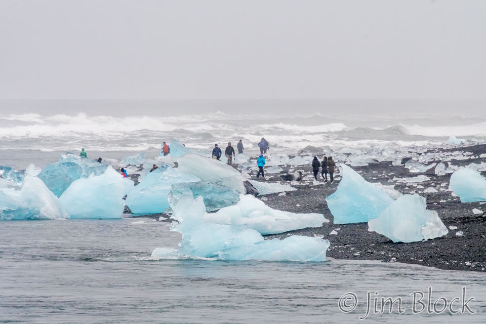
We headed to the Jokulsarlon Lagoon. Marc picked the correct side of the waterway that connects the glacier lagoon to the ocean. Most of the people were on the other side where the icebergs were larger but not nearly as interesting photographically.
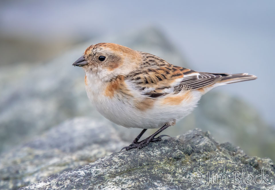
No sooner did we park then I spotted a beautiful bird posing nicely for me. It was a snow bunting, a bird we sometimes see in our area in the winter.
Marc and I had a wonderful time photographing the icebergs on the beach. Here is a brief slideshow of some of the amazing formations we saw. These photos were taken the afternoon of our second day and the morning of our third day in Iceland.
Here is a photographing hint for photographing objects on a beach with waves coming and going. You, of course, want to use a tripod, but my main hint is that most of the best photos are taken when the water is receding.


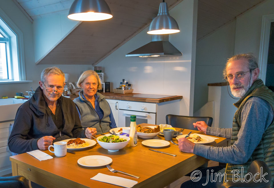
Martha and Stephen cooked up a great dinner for us. I’m not sure what happened to my plate in the photo below. Perhaps I was anxious to take this photo and hadn’t yet helped myself to the buffet.
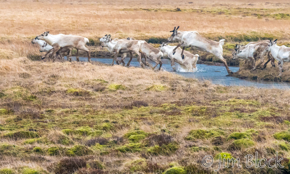
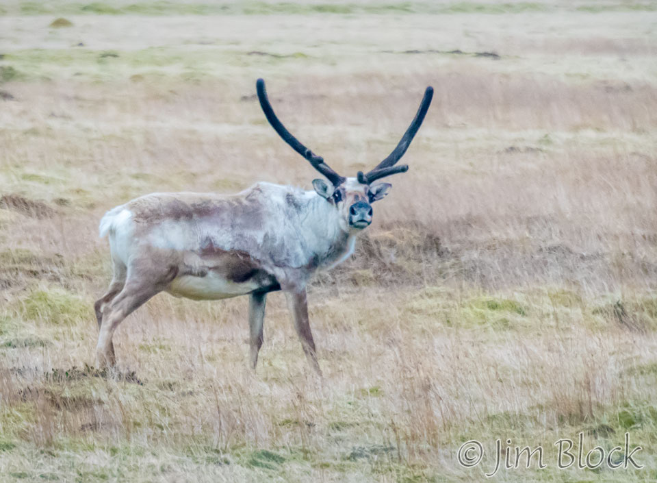
Early the next morning we again photographed the iceberg beach – this time before breakfast. On the way there I was able to get some quick photos out our car window of reindeer at 5:15 AM. Days are long in early May in Iceland.
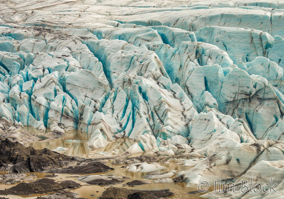
After another great breakfast, the last breakfast that we didn’t serve ourselves with food we bought at a grocery store, we headed back west toward Selfoss. We stopped at the Svínafellsjökull Glacier. I remember the road down to the glacier as being quite terrible. Little did we realize how awful some of the roads in Iceland are. We would find out in less than a week. But at the end of some of these roads are amazing places.
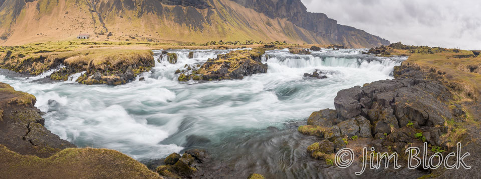
Somewhere along Route 1 (the Ring Road) past Skaftafell, we came upon a beautiful river with small waterfalls just off the highway. Below is a five-photo panorama.
If you click this image you will be taken to an eight-photo image of this scene taken from a slightly different spot. At the site that opens in a new tab you can zoom way in then pan around. When you get there, click the double arrow above the image on the right to see it full frame. Please wait for the resolution to download. You can use the + and – keys to zoom and the arrow keys to scroll. Or use the scroll wheel to zoom and the left mouse to drag.
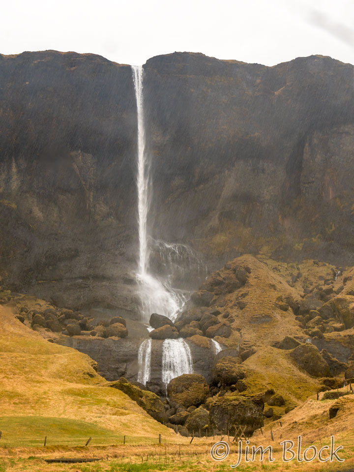
Still east of Vik, there is a very beautiful narrow waterfall, the Foss á Siðu. The river Fossá drops down over a basalt cliff before it continues to the Atlantic Ocean.
On very windy days, this waterfall flows upward, something we saw in the Westfjords.
It was raining when I took these photos between passes of our windshield wipers, if I recall correctly.
According to a local folklore story, a rare kind of ghost wanders the area around the farm Foss and the nearby farm Hörgsland. The ghost is a dog who’s name is Móri, or simply Ghost, who carries with him a curse that was directed at a particular family in the 16th century. The curse was set out to last for nine generations. There are those that argue that the curse has finished its course, and Móri has disappeared forever. Throughout the centuries, Móri has never done any harm to people outside this unfortunate family.
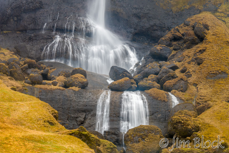
We expected to see a lot of waterfalls in Iceland, and we certainly were not disappointed. Often they form amazing backdrops to farms and small communities.
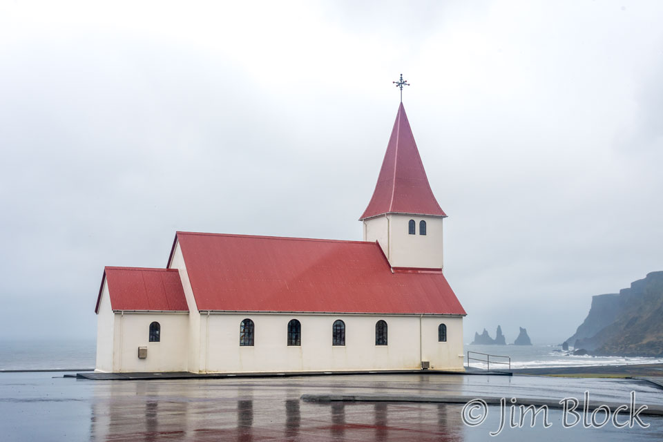
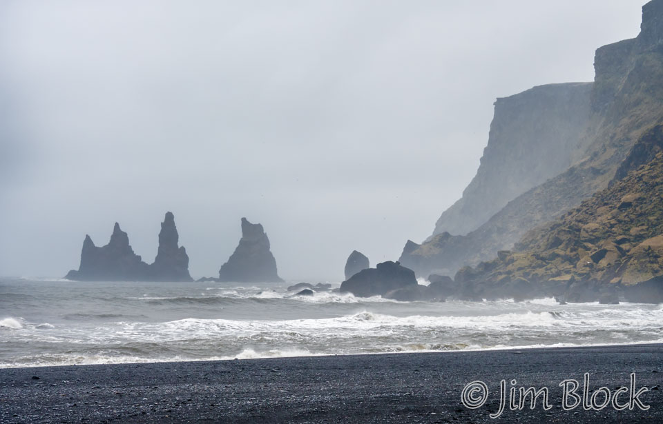
It was raining when we reached Vik, as it had been doing on and off all morning. Vik has an interesting church and some wild sea stacks. This photo makes it look like the church is on the beach, but it is actually on a hill above the town. Many people make Vik the center of their exploration of the south coast, but we were very happy we stayed close to the Jokulsarlon Lagoon.
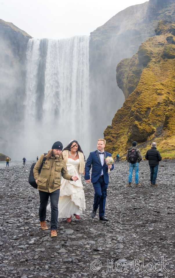
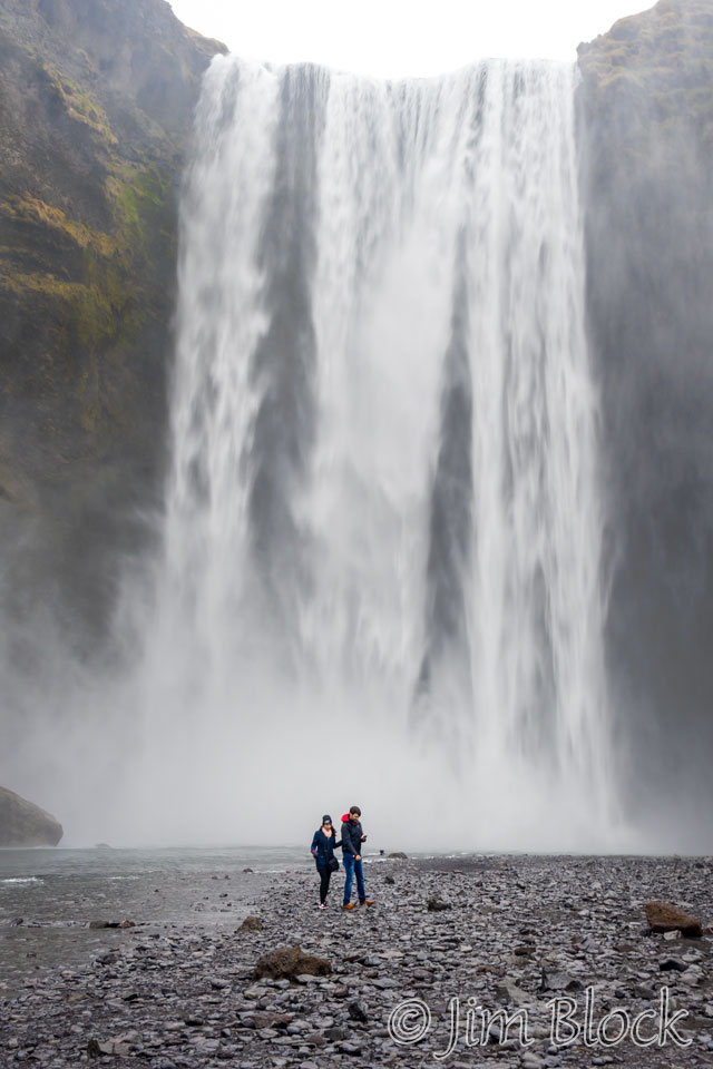
We stopped at the 62 meter high Skogafoss waterfall but decided not to hike to the lookout place above it. The word waterfall is a bit redundant in this sentence since foss means waterfall. Legend has it that a settler named Prasi hid a chest of gold behind Skogafoss.
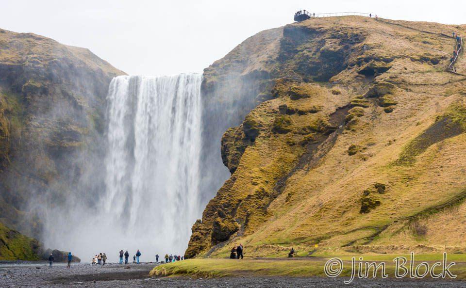
A just-married couple has been posing for photos by the waterfall. Or perhaps the photos were being taken before the wedding.
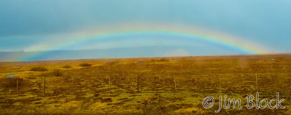
We spotted the rainbow above 30 minutes after leaving Skogafoss. The rainbow is low to the horizon because the sun was still high in the sky, although I don’t recall actually seeing the sun all day.
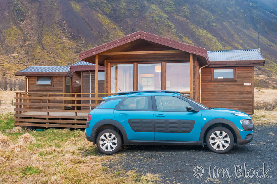
We stayed two nights at a very nice Airbnb, the Alviora Lodge, about 6 km north of Selfoss. Here it is with the car Marc and I rented. Notice how clean the car is at this early stage of the trip. It would get much dirtier when we started venturing off the paved roads.
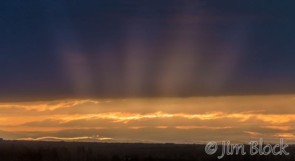
We had a bit of a sunrise the next morning. It was one of the very few sunrises or sunsets with any color that we experienced in Iceland.
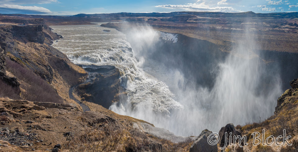
This was our day to do the Golden Circle of Iceland, like any good tourist should. First stop was Gullfoss, an amazing waterfall in the Hvíta River.
You can click this image to get to a site where you can zoom way in then pan around. When you get there, click the double arrow above the image on the right to see it full frame. Please wait for the resolution to download. You can use the + and – keys to zoom and the arrow keys to scroll. Or use the scroll wheel to zoom and the left mouse to drag.
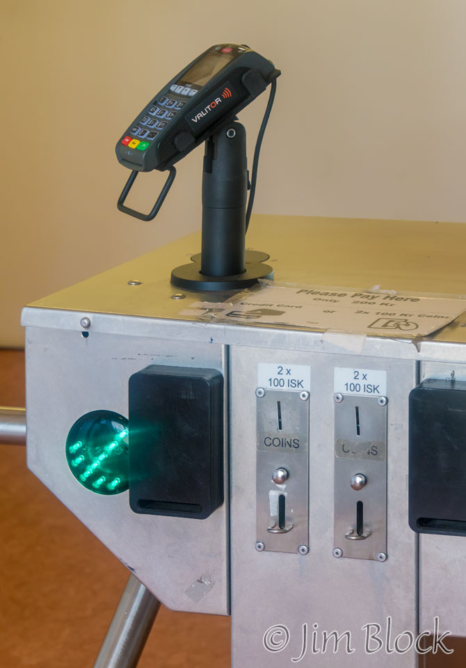
The parking lot for Gullfoss had some pay toilets. But if you didn’t have Icelandic coins you didn’t have to go hunting for a bush to hide behind because they came with a card reader. As I said earlier, Iceland is almost a totally cashless society.
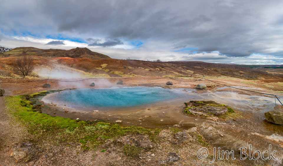
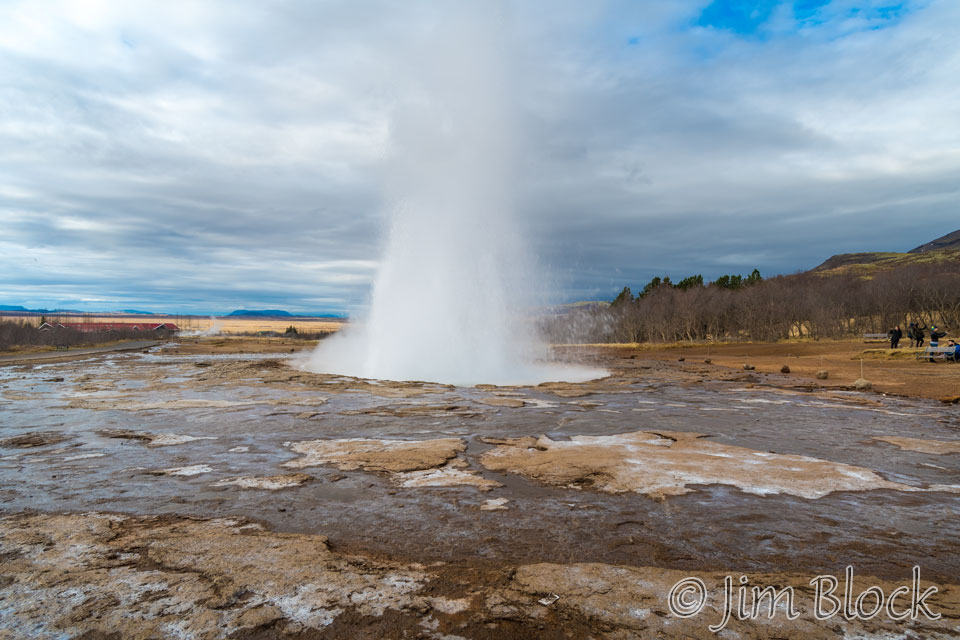
We stopped at Geysir, which was a bit underwhelming. Here is a view of Great Geysir which erupts very rarely.
However, the nearby geyser, Stokkur, erupts fairly regularly. Here it is putting on the best show it could.
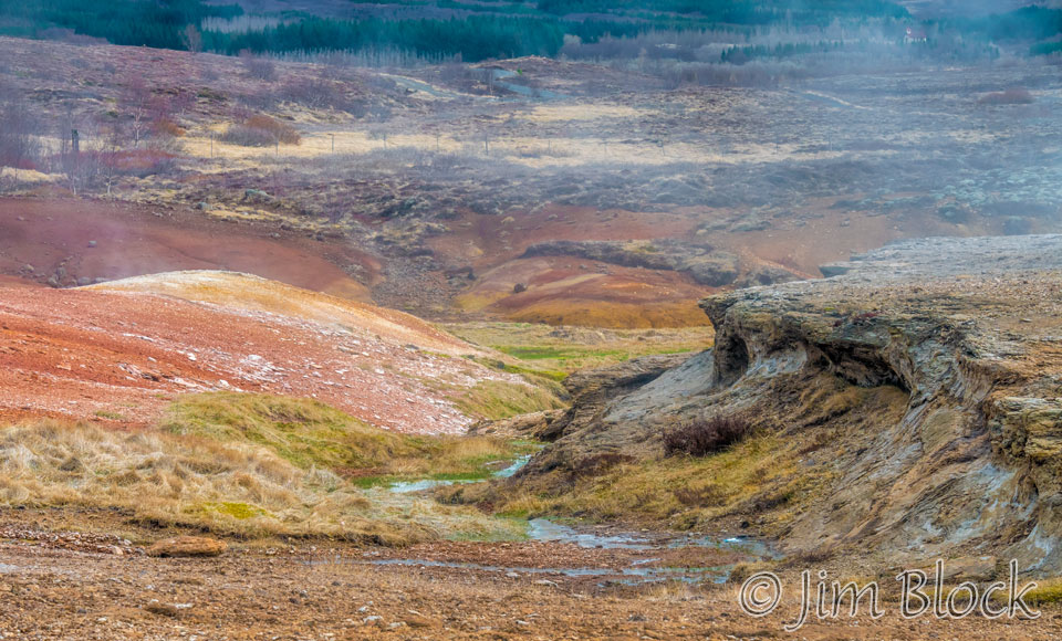
I found the scenery near Geysir as fascinating as, or more so, than the geysers themselves. Along the top edge of the photo below you can see some of the rare trees that exist in Iceland. I believe I can see more trees out my windows at home than are in the whole country of Iceland.
Heading to þingvllir National Park, the third spot on the Golden Circle, I got a photo of a beautiful horse, a flying Whooper Swan, and some interesting lava and earth patterns. þingvllir is also known as Thingvellir.


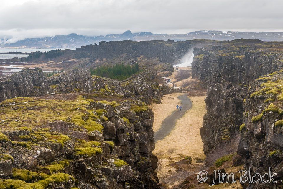
When we were at þingvllir National Park, I didn’t realize what we were actually seeing. The valley in the photo below actually separates two continents. On the left the North American plate is moving slowly to the left, and on the right the Eurasian plate is moving slowly to the right. We walked right between two continents.
Iceland is divided by the Mid-Atlantic Rift; some parts of it are on the North American tectonic plate, while others are on the Eurasian plate. Iceland is the only place in the world where this rift is above sea-level, and nowhere can you see the edges of both plates as clearly as in Þingvellir. The tectonic plates move apart at approximately 2.5 centimetres (one inch) a year and have done so for millenniums.
þingvllir National Park was certainly the most interesting stop of the day. It is the only UNESCO World Heritage Site on the Icelandic mainland. There I photographed the beautiful Oxarafoss (waterfall), a robin-like Redwing, and some Black-tailed Godwits. Here are some of the photos I took in the park.


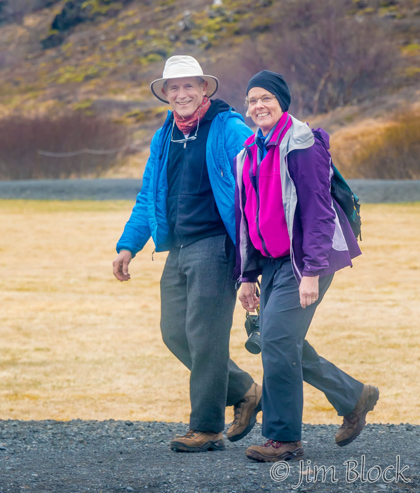
After a rugged hike in the morning, Stephen and Martha visited þingvllir, recognized our vehicle, and stuck a note on our windshield. I saw them approaching in the distance and waited to get some photos of them walking along.
Later in the day we were all back at our lodge resting and thinking of dinner. This was the second dinner Marc and I would buy and prepare.
Note the hill behind our lodge. Earlier that day Martha and Stephen had scaled it. As I said earlier, they were into hiking, and some of it was somewhat adventurous.
![]()